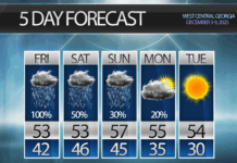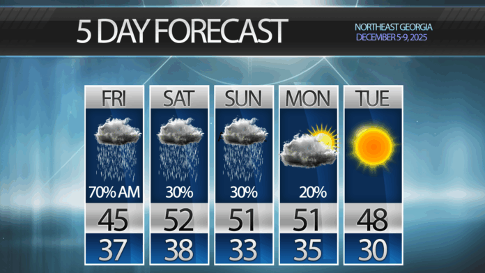
We will remain just on the northern edge of the rain through the weekend keeping some isolated showers around.
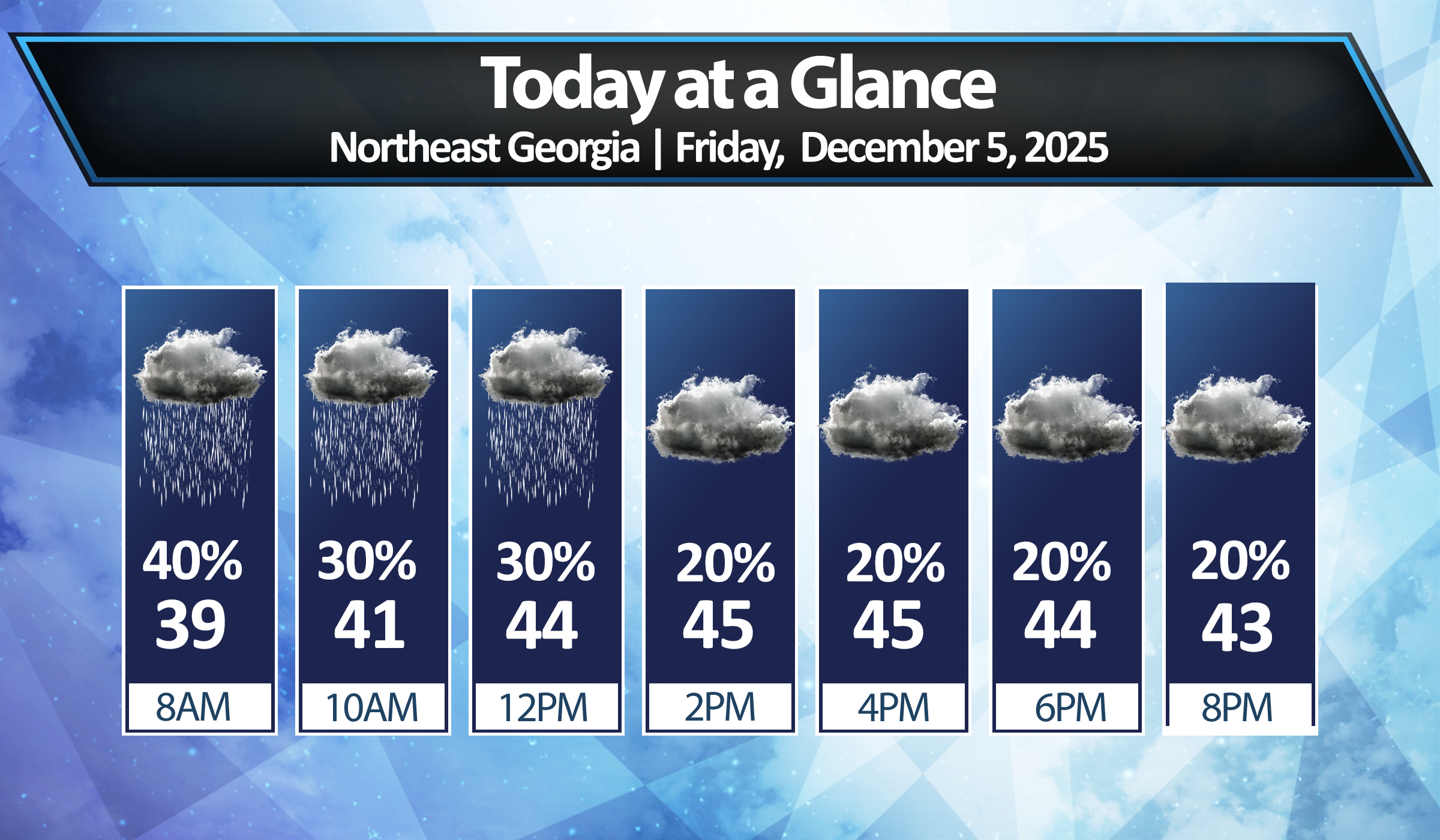
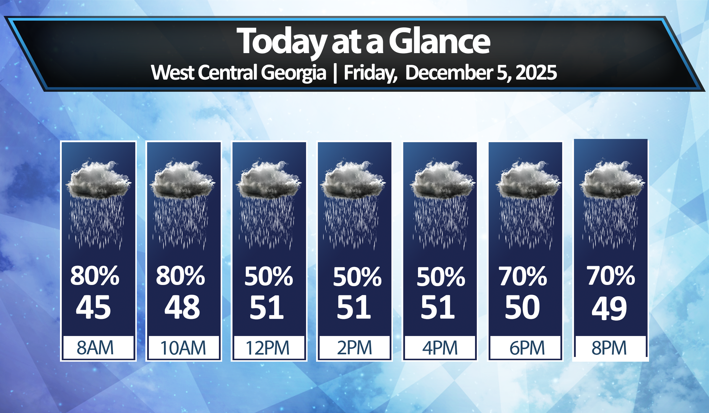
Expect Friday to be a fairly miserable day weather-wise. We’ll see showers early, followed by drying conditions but highs only in the mid/upper-40s and remaining damp. A couple waves of low pressure will develop to our south and send more rain northward, but right now it appears most of that will be limited to the I-20 and south parts of the state. Luckily, these are the areas that most badly need the rain to ease drought conditions.
Models remain split in the mid-range forecasting of Monday and Tuesday. The Euro brings another more organized low that would bring more widespread showers to us on Monday, while the GFS is almost entirely dry with a frontal passage from the northwest.
We’ll be keeping an eye on this going forward and keep you up to date on any changes!

