

Editor’s note: In July 2025, Now Habersham weathercaster Tyler Penland headed west to hike and camp in Yellowstone National Park. His latest “Go west, young man” series features the stunning images he captured and the stories he brought back.
I can’t say I slept great at 10,100ft elevation near Shelf Lake, but I didn’t sleep terribly. At any rate, when I woke up well before the sun on the morning of July 28 I knew I had the hardest hike of my life ahead of me.
While I spend as much time as possible at higher elevations here on the west coast, the highest that can still possibly put me is 6,000ft. I was about to double that. All week we had slowly been making our way higher and higher through Yellowstone and eventually the Beartooths, but our true goal lay ahead. Neither my buddy nor myself had ever summited a 12,000ft peak on foot. I have been to the top of Pike’s Peak at 14,000ft but only by car. The highest I had personally ever hiked was a touch over 10,000 and certainly nothing as difficult as what lie in store. We packed up and headed backwards and downwards along the trail just as the sun began to hit the ridge to our west.
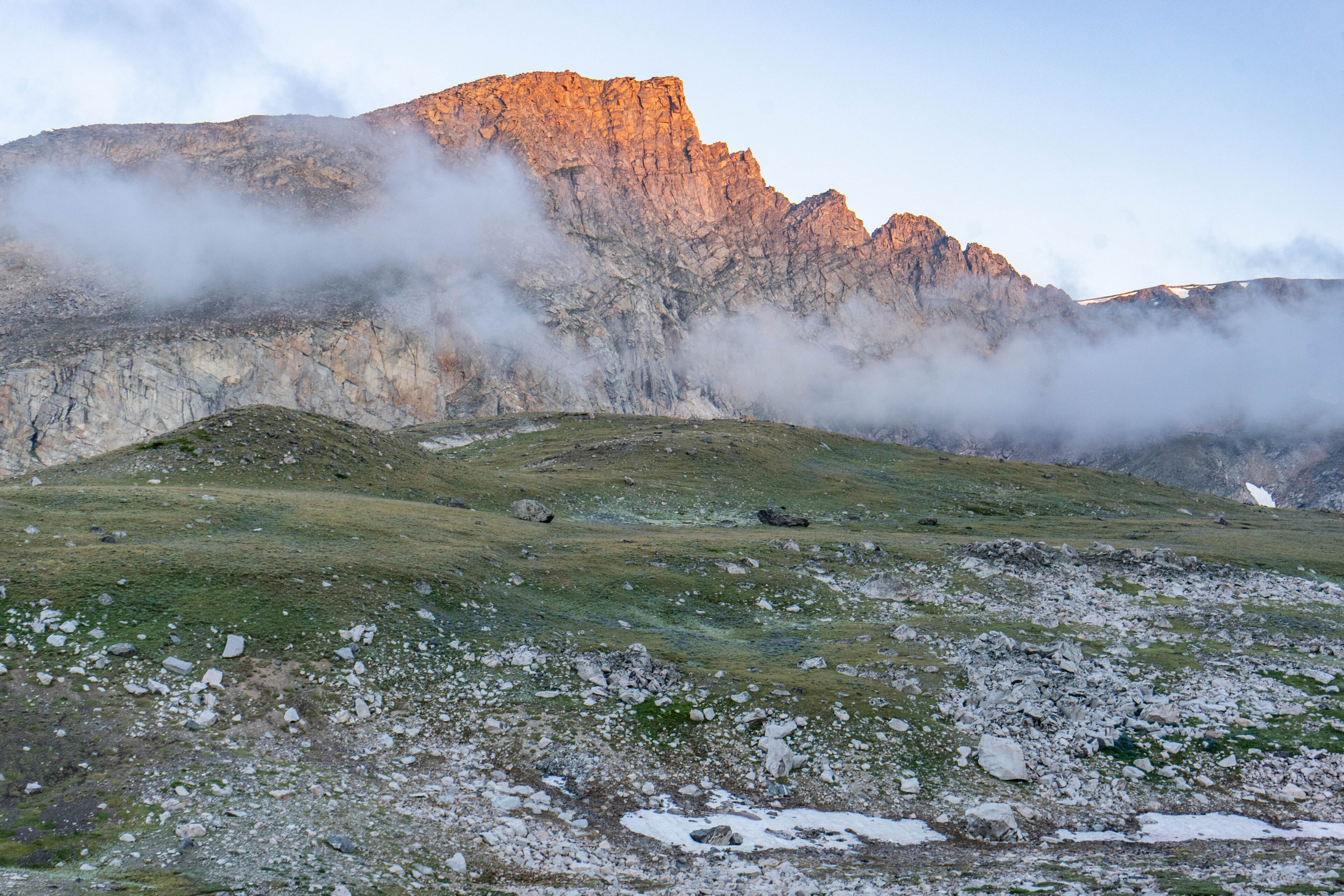
You never know quite what you are going to get with weather at these elevations, but luckily for us it was a bluebird day after the brief early morning low clouds and a very brief bout of mist. Temperatures were around freezing at daybreak but would quickly climb into the 40s and eventually 50s along our route. We made our way downhill about a 1-1.5 miles where we stashed our overnight packs and unclipped our day packs that would take us to the summit of Mt. Rearguard. We left the trail, and that was the last we would see of any organized route for the rest of the trip.
To put it very lightly, there are no easy ways to reach Mt. Rearguard. We had opted for the shortest way, but shorter usually means steeper. Having now “been there, done that” I can confirm it is a very steep approach. We were very rarely able to go straight up the hill, but instead had to zig zag our way up the steep, rock-laden slopes. Our climb took us up very quickly accomplishing our first 1,000ft gain in a little over a mile. I didn’t take a ton of photos on the way up as I was mostly concerned with not dying, but the views were certainly breathtaking.
When we finally reached the top of the first rise it put us out about 11,400ft above sea level and I was really starting to feel the elevation. From here, we could see the rest of our root. You may be thinking to yourself ‘that doesn’t look too bad’. This thought briefly went through my mind, but now it was back to a slog back downhill to the saddle below.
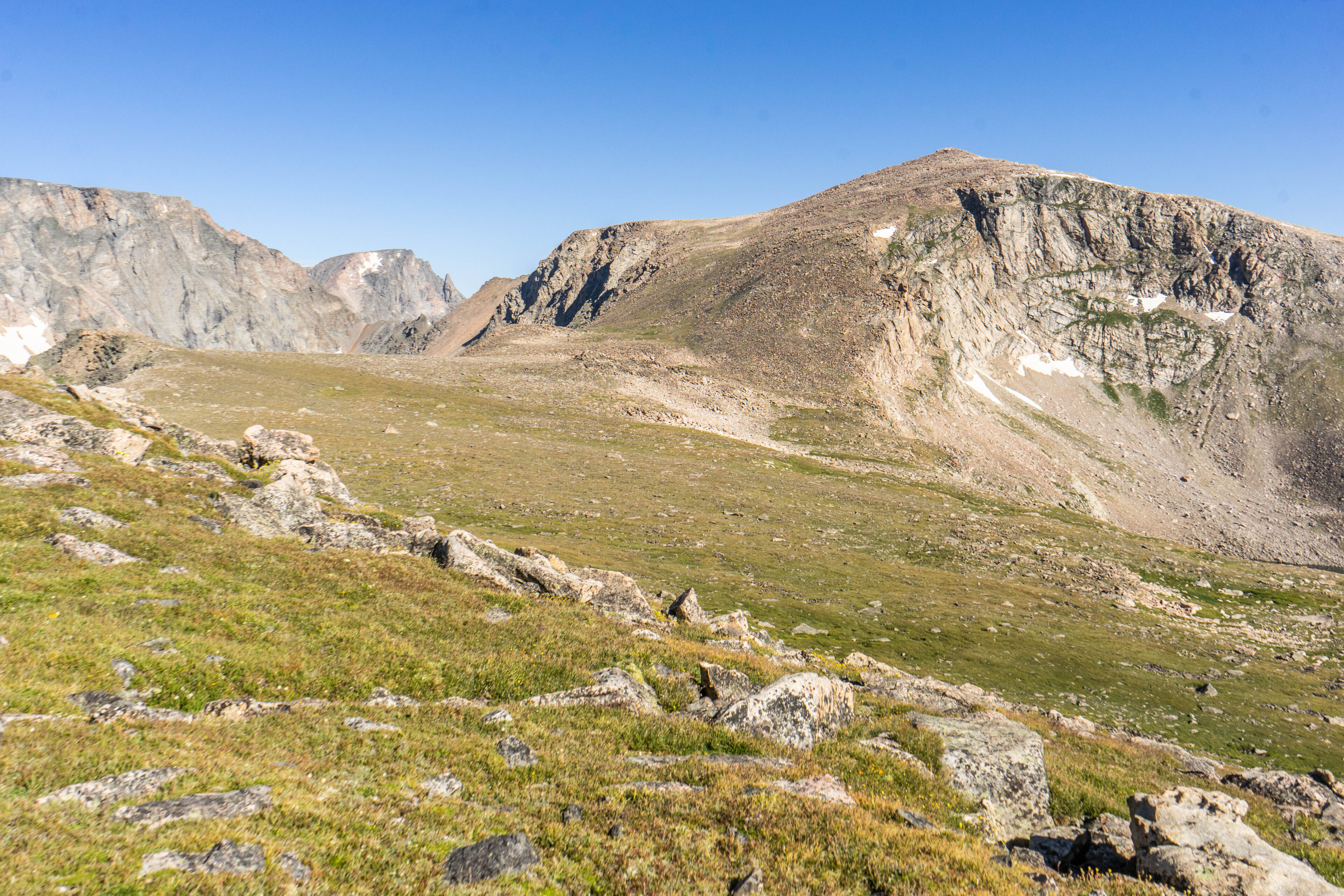
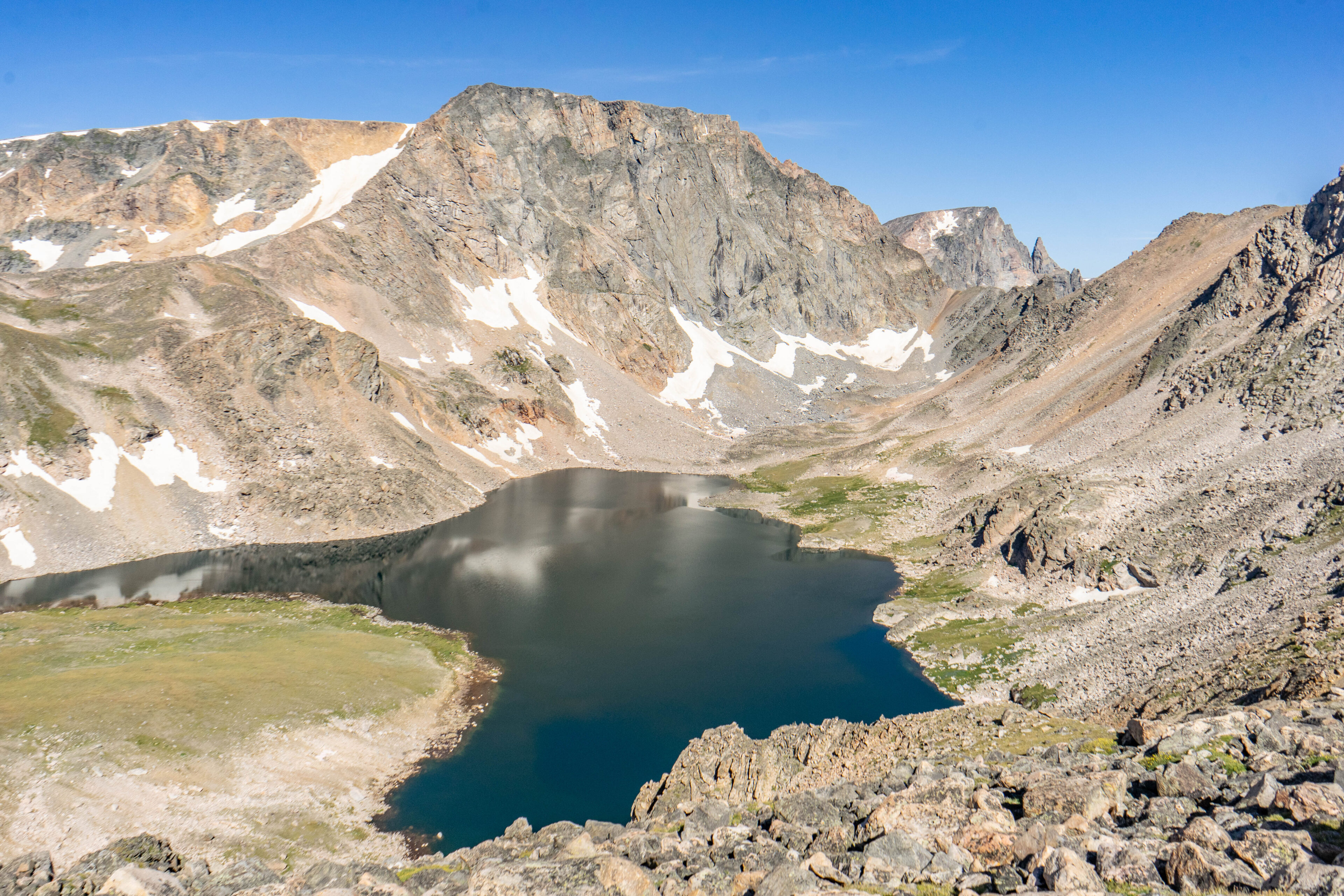
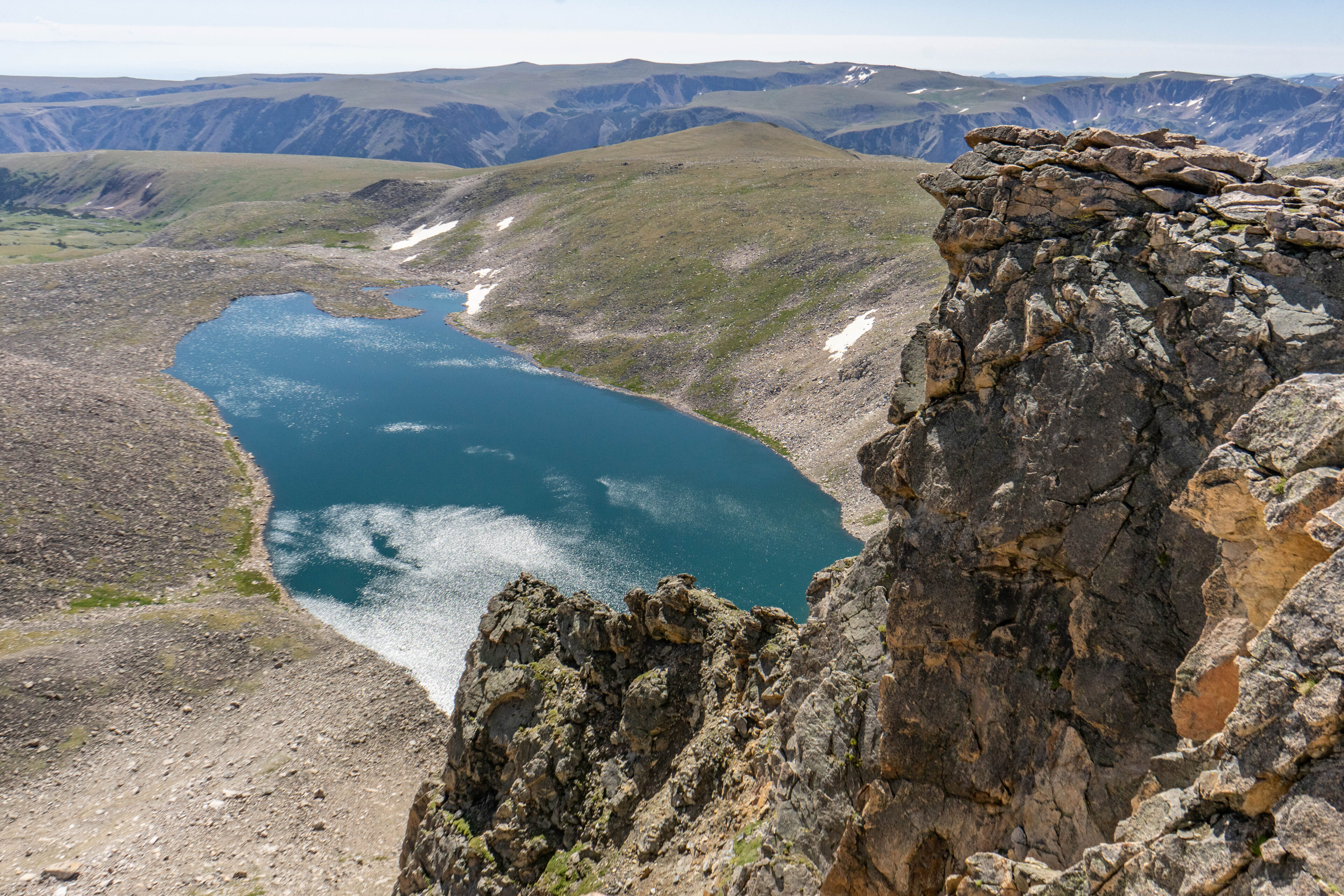
You may notice the ridiculous number of rocks in our way. This landscape was carved out exclusively by glaciers and as they melted they left behind a seemingly infinite number of boulders. Our path zig zagged between these boulders ranging from the size of your fist to the size of a VW bug as we approached the final summit bid. From here, you have about 1,000 vertical feet to climb in right around 1 mile or a bit less depending how you choose to go. We were lazy, stupid, or a mix of both and after studying our topographic maps decided it would be just as easy to go straight up. The beautiful Moon Lake that we had failed to reach the day prior lay out beneath us reflecting the snow and small glaciers below.
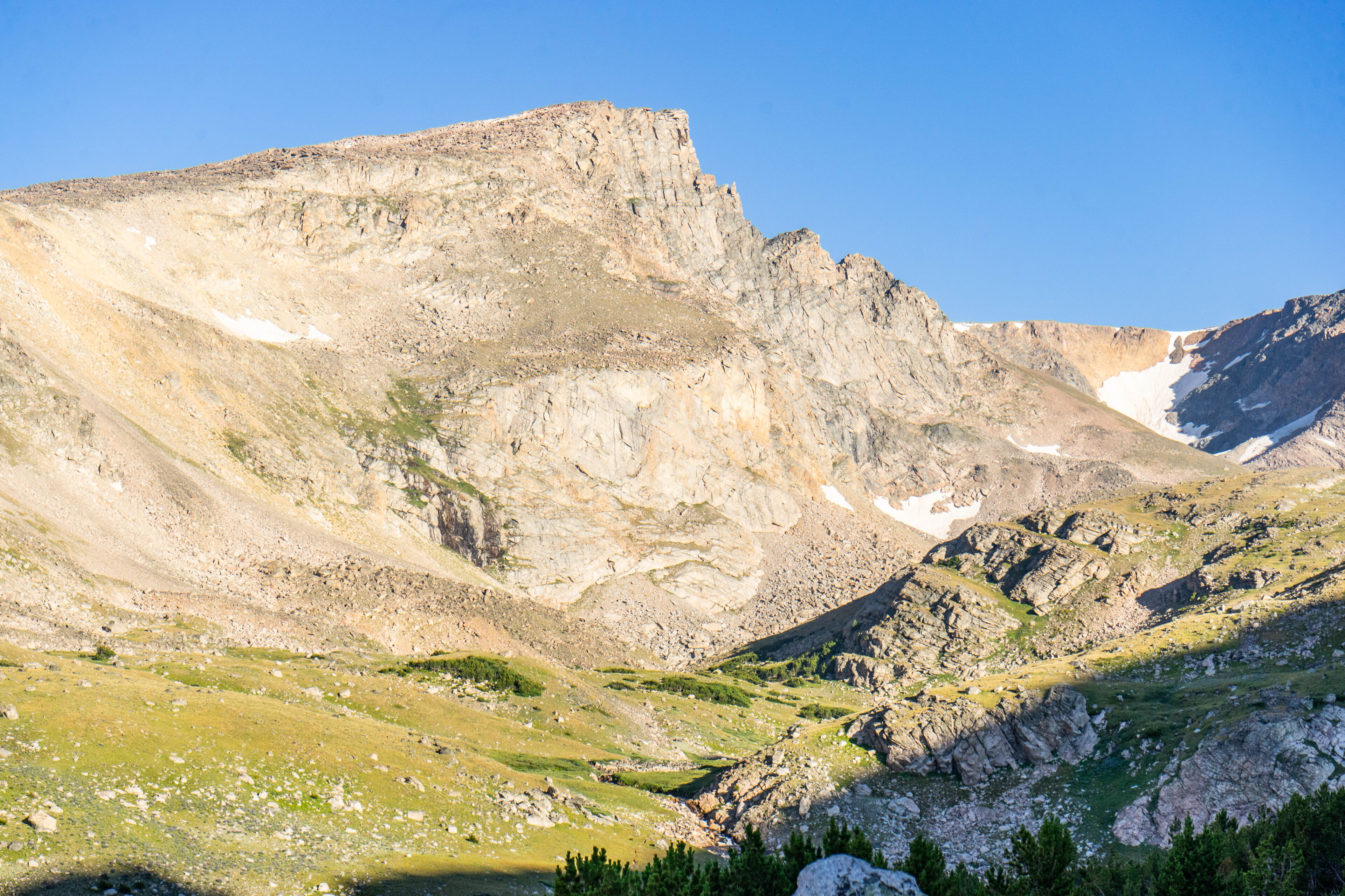
From up here, the views of the Hellroaring Plateau are astonishing. The beautiful weather and low humidity allowed us to see for no doubt hundreds of miles. If you look closely in the image of Mt. Rearguard above you’ll notice a very dark notch directly below the summit. Well, the view from there was like something from another world. A small glacier is located at the bottom of that notch, but the views back towards Sliderock Lake really steals the show.
Now came the final summit bid. The elevation was really starting to beat me up by this juncture, and I was only able to go 20-25 yards at a time as we neared the peak. Up here, the air is thin and the terrain is difficult. There’s nothing even resembling a “trail”, and the boulders have gone from VW-bus-sized to small-house-sized requiring very careful route finding to not get yourself stuck in a corner.
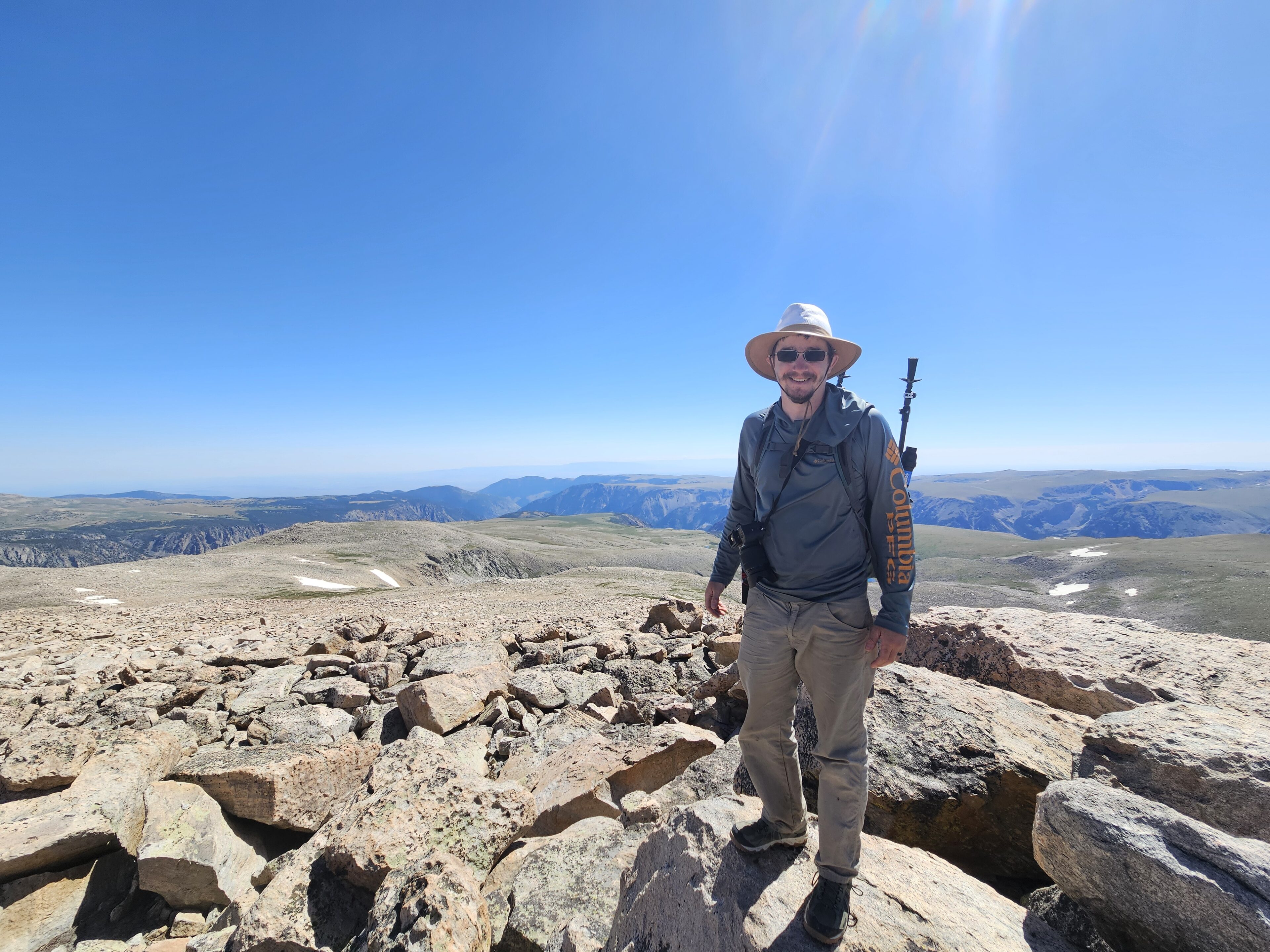
Finally, around 4.5 hours after we set off we made the top of Mt. Rearguard at 12,209ft elevation. I really can’t describe how I felt at the top of this mountain, partially because I was out of breath, but mostly because just an hour earlier I wasn’t sure if I was going to make it. I’ve read stories of people climbing high mountains, and while this one isn’t exactly a walk in the park it is certainly one of the “easier” options. Easy still whooped my butt.
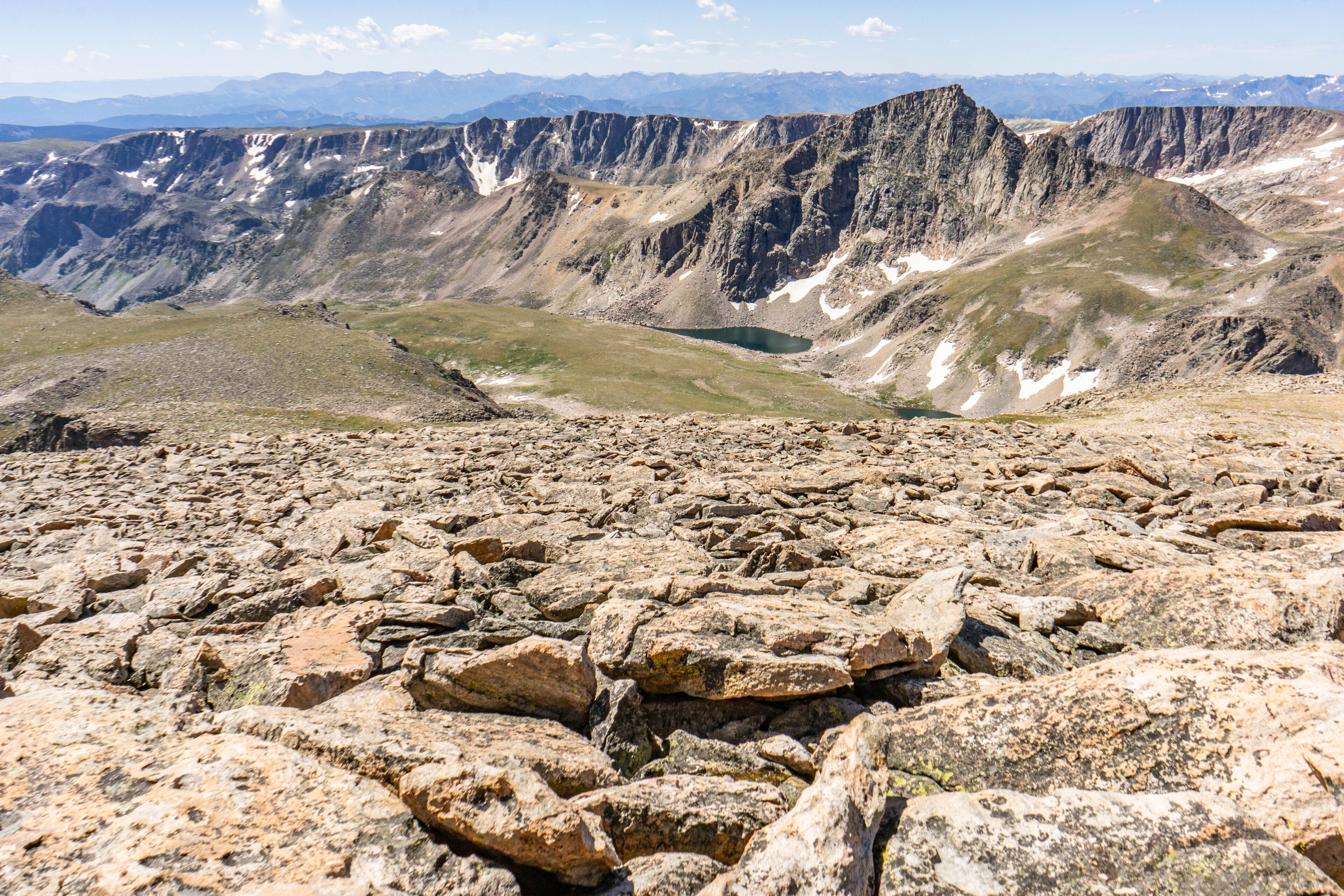
The view looking back towards our route from the summit reveals the expanse of boulders we just came through, though it lacks the scale of just how big they are. The lyrics from one of my favorite Jimmy Buffett songs came through perfectly clear in my worn out brain:
“Take it all in, it’s as big as it seems”.
I made it to the top, but the hard part wasn’t over.
Check out Tyler’s other articles in this series
- Go West, young man: To where it started
- White Mountain
- Bunsen Peak
- Norris Geyser Basin
- Star light, star bright
- A ‘Faithful’ meeting
- Shattering Earth
- Isn’t She Grand?
- Canyons of Time
- Cranes and Bison and Bears, oh my!
- Leaving Yellowstone
- The Beartooth Highway
- The First Climb


