

Editor’s note: In July 2025, Now Habersham weathercaster Tyler Penland headed west to hike and camp in Yellowstone National Park. His latest “Go west, young man” series features the stunning images he captured and the stories he brought back.
We had done it, we had summited the 12,209ft Mt. Rearguard and now a daunting task lay ahead of us: getting back down. If you read my last installment, I don’t have to tell you that going up absolutely kicked my butt. The elevation, coupled with the sun exposure and relative lack of sleep the past few days had worn me thin. However, we still had a 5 mile trip back down to our truck before we could really relax. Anyone who has done much hiking knows that going down can be just as grueling as going up. In fact, anyone with questionable knees probably prefers going up. In our case, both were difficult.
Our “trail” back down from the summit required boulder hopping once again. Going down can be more dangerous than going up, because it is much easier for your legs to get ahead of you, especially when you are tired.
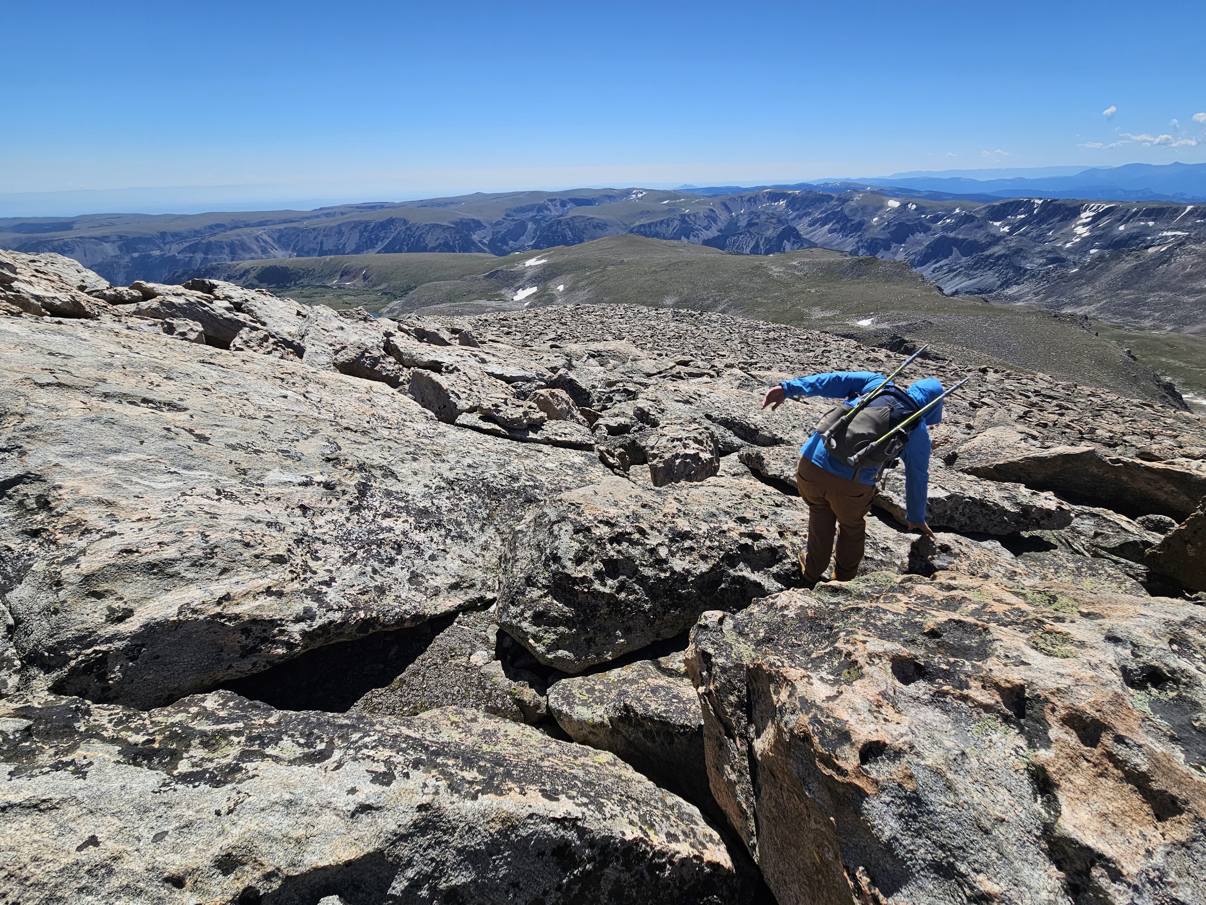
Some of the boulders we were jumping between were the size of cars, and you had to carefully pick your way through. It is exhilarating hiking, but boy does it get frustrating after the first mile or so.
Luckily for me, and very unluckily for him, my buddy’s knees aren’t in the greatest of shape which meant we made several stops on the way down. To be honest, we stopped more on the way down than on the way up. I think if we had stopped on the way up more I may not have made it, but I took full opportunity to get some spectacular photos of the area on the return. The stark ruggedness has a beauty all its own.
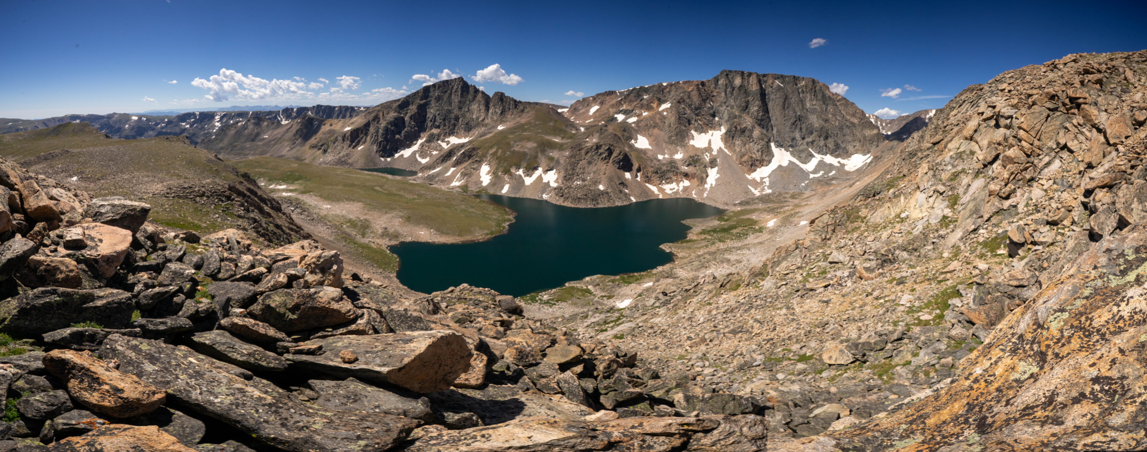
I took a short scramble out on a ledge to capture a panorama of the steep climb we had made from below. The large moon lake lay directly below, with part of Shelf Lake, our overnight camping spot, lies beneath it. A couple thousand feet down and 2 miles left from there lie our truck- still a long haul to go.
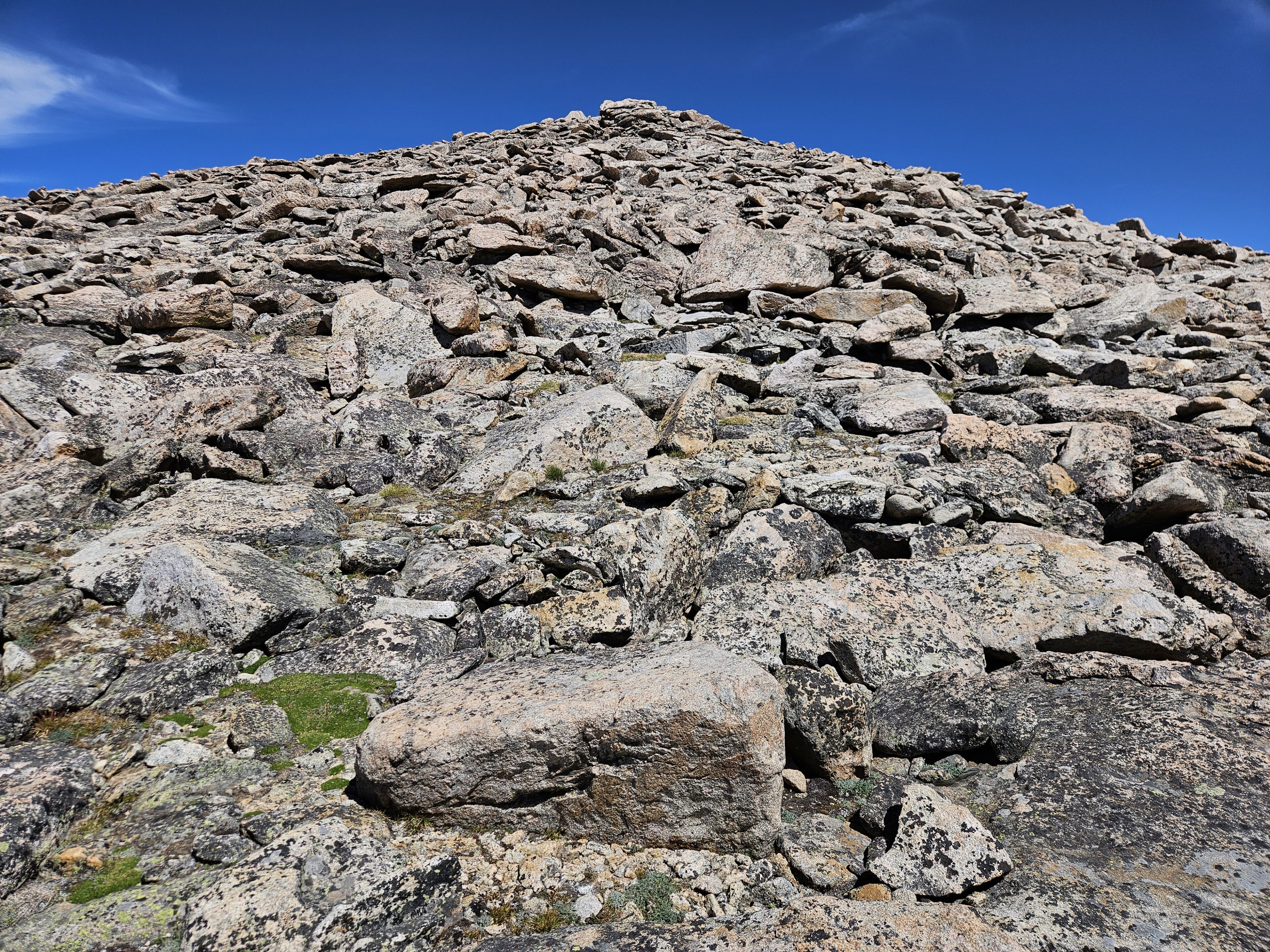
It is very, very hard to get across just how steep some of these slopes you wind up climbing are. While they don’t require rope, it might honestly be easier if they did. The entire 3-4 mile drop from the top of Mt. Rearguard back to the trail was steep, rocky grades. I believe the photo below does the best job of capturing these extremely steep slopes of any that I took.
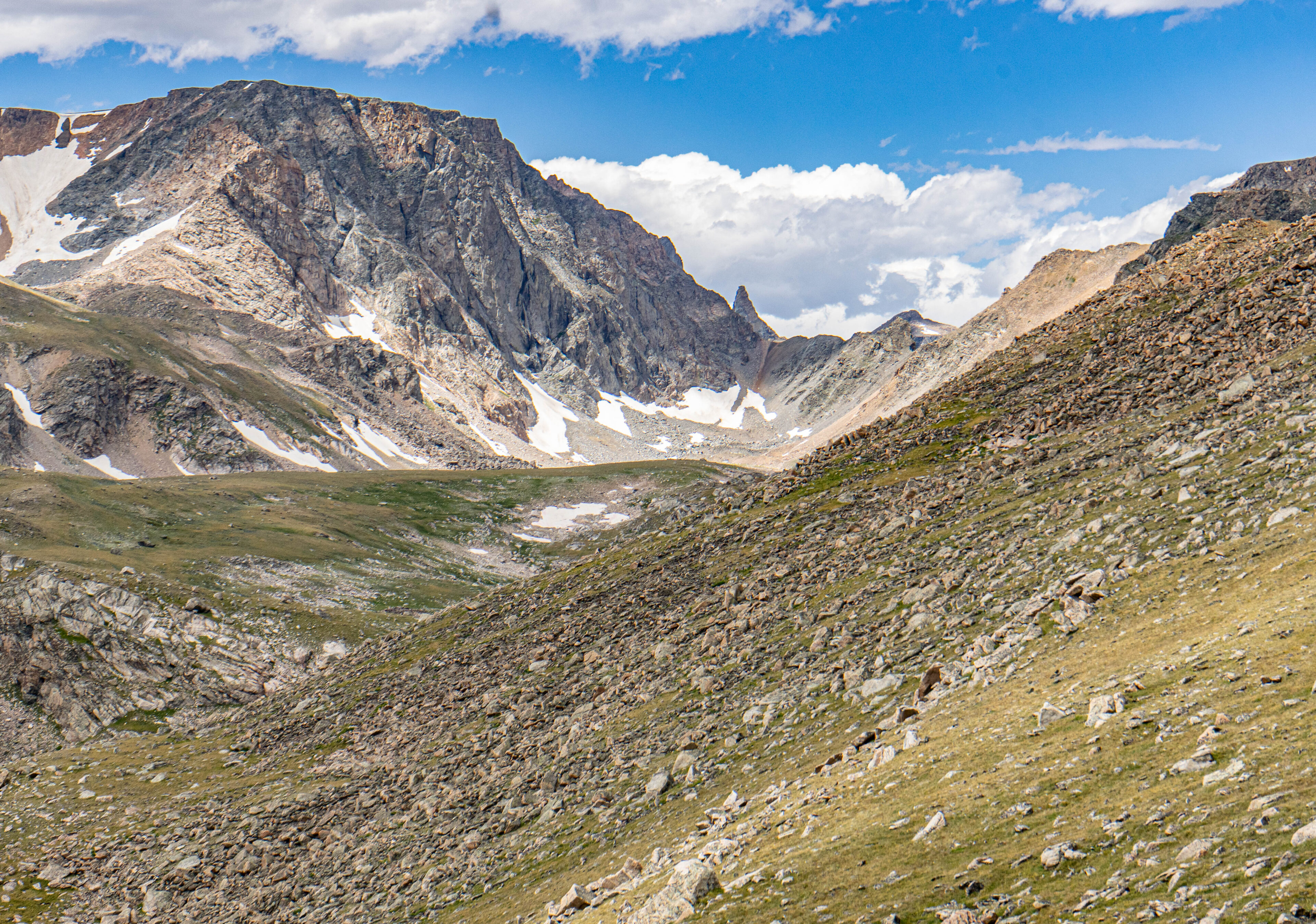
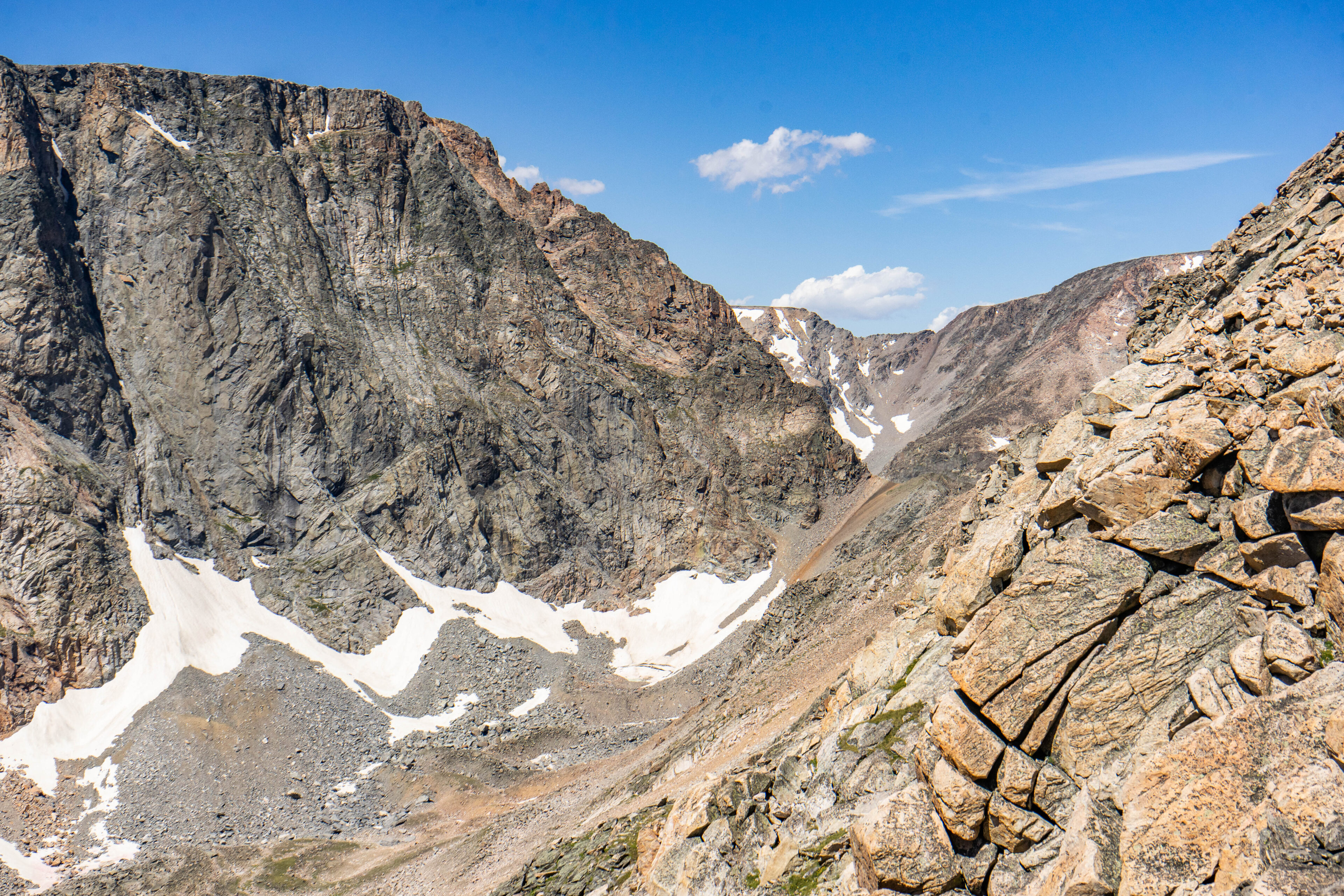
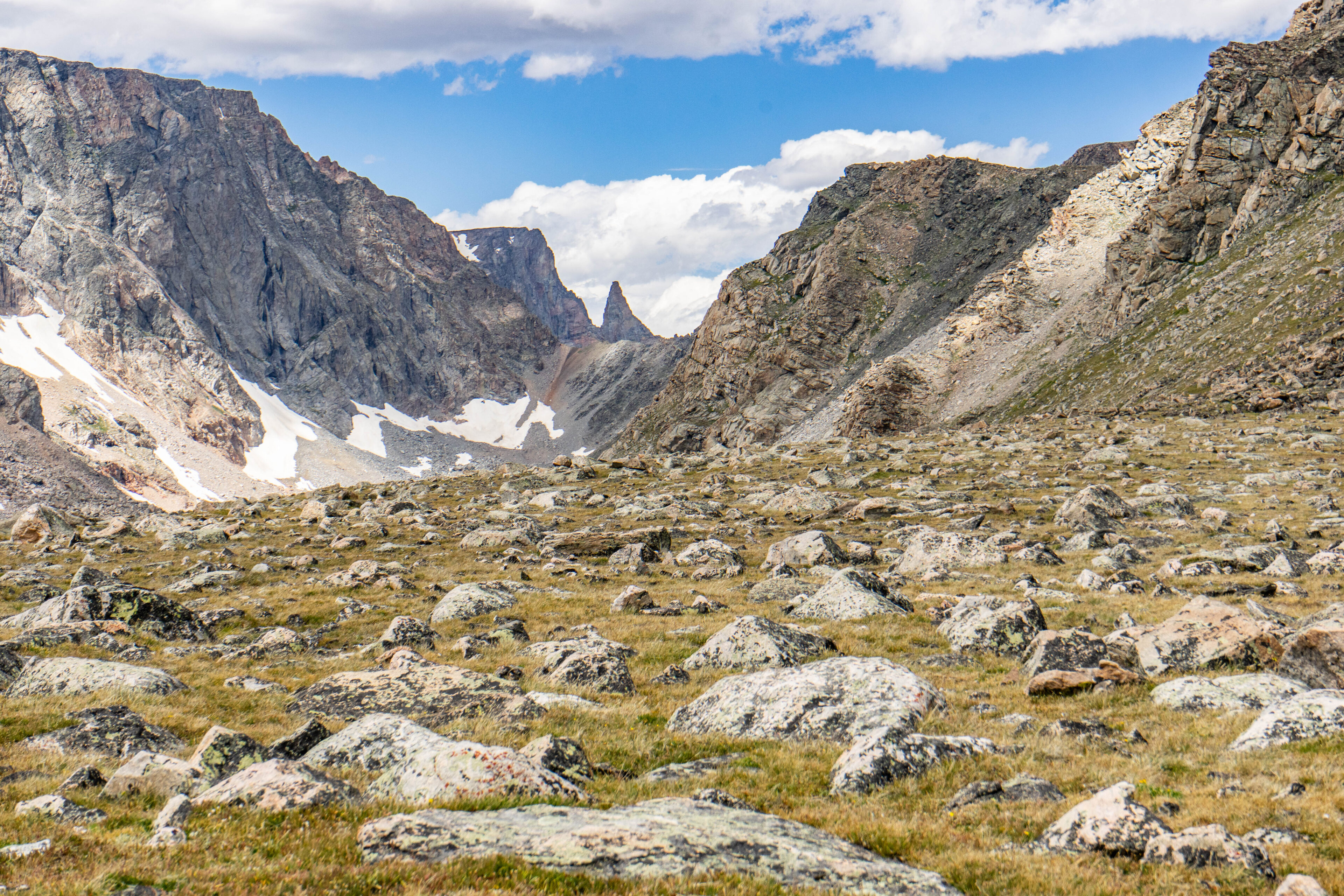
You may have wondered over the past few installments why they are called the “Beartooth Mountains”. While the jagged, saw type tops certainly resemble teeth, there is one peak that stands out and gives these mountains their names. The Beartooth itself is visible from many places around the region, but perhaps nowhere better than around Mt. Rearguard. From our vantage point on the ridgeline the Bear’s Tooth rises high above the near mountains and is framed by the steep valley. This peak is the next one over once you leave the northwest side of Mt. Rearguard itself.
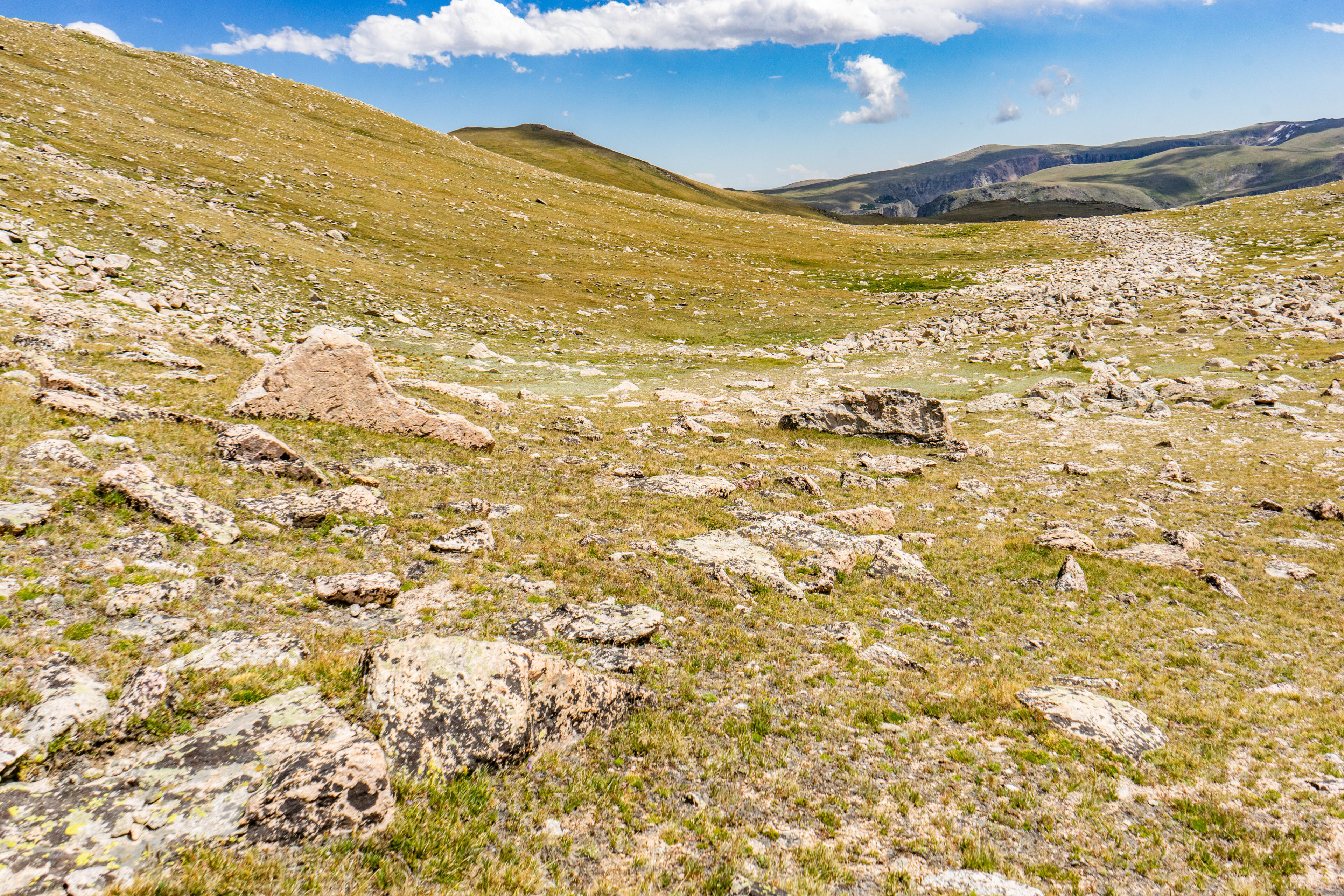
As we reached near the bottom we took a slightly different route down than we did up. This extra distance allowed our knees some rest from the constant pounding of the steep downhill and offered us a slightly less steep descent in general. This route took us through a scene that looks like it came straight out of a Windows background, assuming that background had been run over by a glacier about 10,000 years ago.
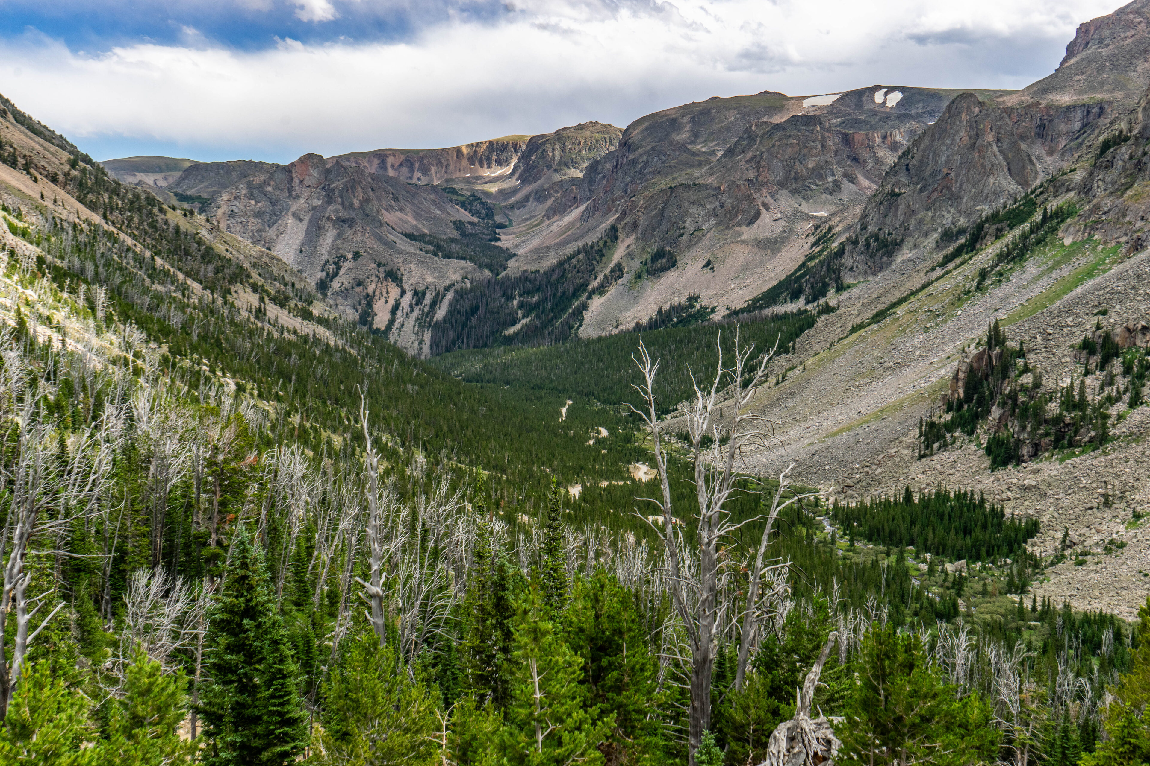
After a couple of hours of knee and foot beating downhill, we finally reached our packs. After reattaching our day packs we now had…. even more downhill. From this point on I took very, very few photographs of the trip back down. Every bone and muscle in my body hurt, and I could feel my blood sugar starting to drop down. The steep ascent we had made the day before now seemed even steeper on the way back down. I did take one more photograph during one of our last stops. This is the final photo from my camera, taken probably around a half mile above the truck looking down towards our final destination.
As the truck itself came into view, I dropped my pack and collapsed on the tailgate. We had made it. A week full of geysers, canyons, lakes, stars, and 12,000 foot peaks was behind me. The adventure of a lifetime was over.
“Go west, young man”. Boy am I glad I did.
Check out Tyler’s other articles in this series
- Go West, young man: To where it started
- White Mountain
- Bunsen Peak
- Norris Geyser Basin
- Star light, star bright
- A ‘Faithful’ meeting
- Shattering Earth
- Isn’t She Grand?
- Canyons of Time
- Cranes and Bison and Bears, oh my!
- Leaving Yellowstone
- The Beartooth Highway
- The First Climb
- To 12,000ft and Beyond


