

A long term drought has maintained across much of Georgia over the past week with very little rainfall occurring.
Most of Northeast Georgia has been eliminated from the drought in the past 2 weeks with just enough rainfall to ease the short term deficits up, but for the rest of the state it remains very dry. The latest from the US Drought Monitor continues to show 89.81% of the state in at least abnormally dry conditions, the same as last week.
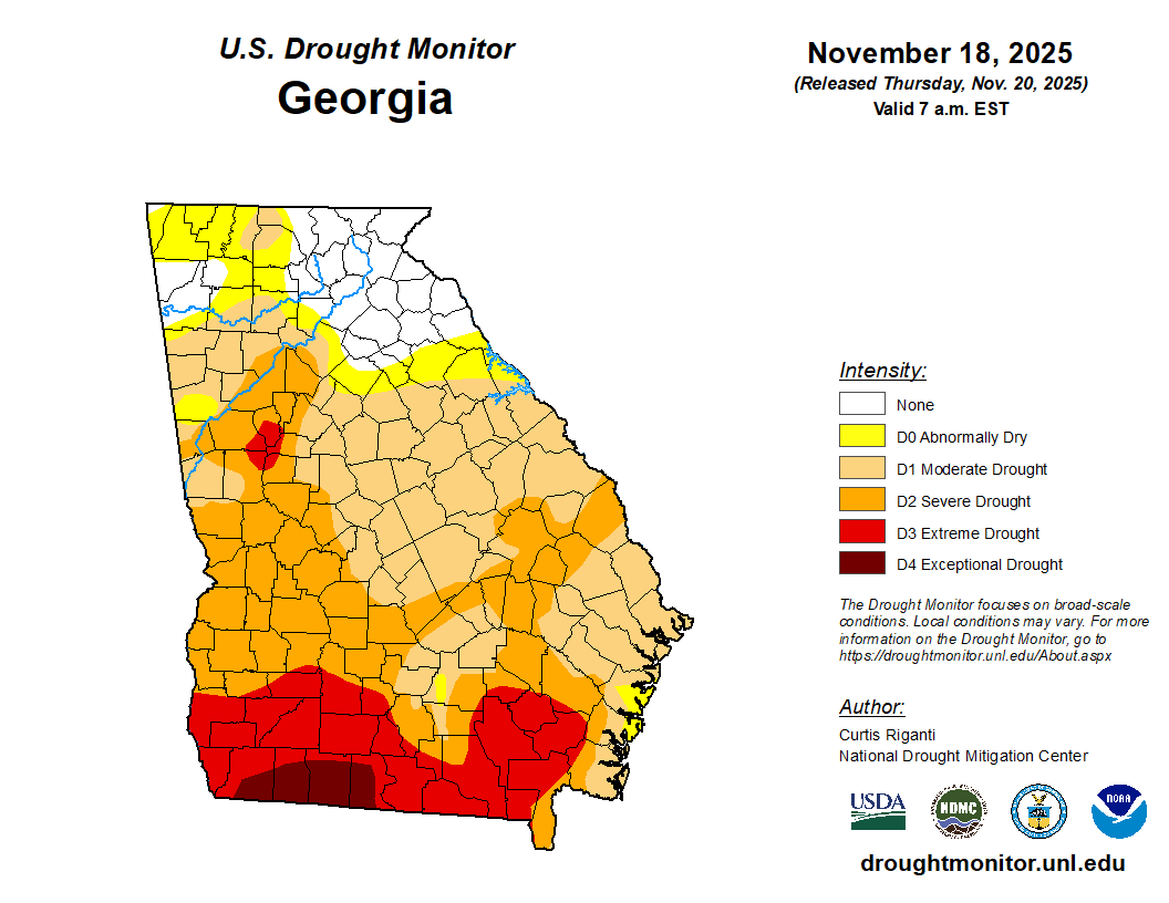
For the northern half of the state, the only D3 (extreme drought) remaining lies in a small area southwest of Atlanta and to the northeast of Greenville. Outside of that a very large D1 (moderate drought) area still exists with every county south of I-20 with at least this category. The western half of the state from roughly I-20 south continues to be in mostly at minimum D2 (severe) drought. Over far south Georgia conditions continue to worsen with a large area of D4 (exceptional) drought to the west of Valdosta. Some spots in that area are as much as 10-12″ of rainfall short over the past 90 days. You can see the statewide deficits below for the past 90 days. Atlanta continues to have the largest deficit of the major reporting sites at 7.2″ under, with St. Simons Island just behind at 7.1″.

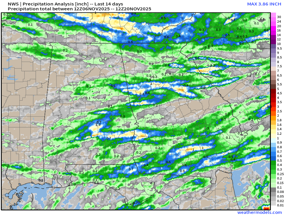
While 90 day departures do run as much as 5-6″ across the northeastern part of the state, rainfall over the past 60 has been good enough to remove any drought issues. Over the past 2 weeks, seen below, rainfall has been spotty at best with the majority of the state receiving less than 1/4″ and almost no spots above 1″.
Unfortunately, for those that need the rain the most it looks very dry for the next 7-10+ days. While the northern half of the state is expected to pick up anywhere from 1-3″ in the next week with a pair of cold fronts, further south some locations will likely receive nothing at all. The latest from the European model paints this picture quite well, with the higher totals over areas that have already seen drought improvement.

Because of this, high fire danger is expected to continue over the coming weeks from I-20 southward. Keep a close eye on any fire danger statements and for any local ordinances for water usage.


