

The latest from the US Drought Monitor is out, and the drought continues to gradually worsen across much of the state. The large area of D2 drought has continued to expand and now includes both Columbus and LaGrange.

As of this week, most of Chattahoochee, Muskogee, Harris, Marriot and Talbot Counties are under a D2, or severe, drought. This is a slight expansion over last week’s number. There is a fairly sharp cutoff to the east where more rain has fallen in recent weeks. Since the update last week, only the far east/southeast part of the region saw any significant rainfall. Further north a few showers did bring some decent totals to parts of Northwest Georgia, and the coast picked up on some rain from the nor’easter. Americus and the surrounding area did see some nice totals of around 1/2″ or so with over 1″ further east.
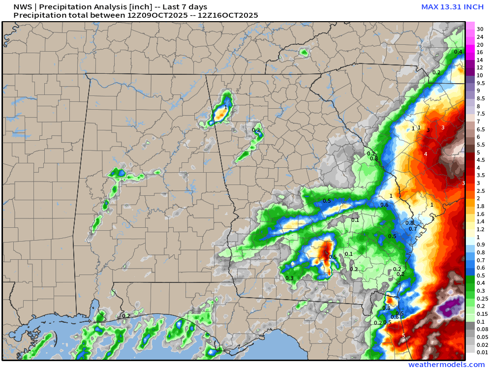
Overall, the total area of Georgia in a drought did decrease by about 1%, but all categories from D1-D3 saw expansions. Far southwest Georgia is in by far the worst shape with widespread extreme drought. Below you can see what percentage of normal rain has fallen in both the past 30 and 60 days. While there are some areas that have seen normal rainfall, they are extremely spotty and in many cases completely surrounded by spots that didn’t. The nature of afternoon storms in late summer without any tropical input lends itself to this type of situation.


As far as rainfall deficits go, those also vary quite significantly. Columbus proper has a 60 day deficit of 3.6″, but just outside of town to both the north and south that number quickly approaches and in cases exceeds 5″. The eastern parts of the region, roughly Americus and south/east are in the best shape with only around 1-3″ deficits.

Unfortunately, it appears we will continue to remain mostly dry for the next 7-10 days. A cold front will bring some showers to the region on Sunday, but currently those are expected to be quite light. Weather models are still a bit split, with the Euro bringing higher totals than the GFS model, but in general the front does not look overly impressive. Further north higher totals are more likely across North Georgia and especially west into Alabama.
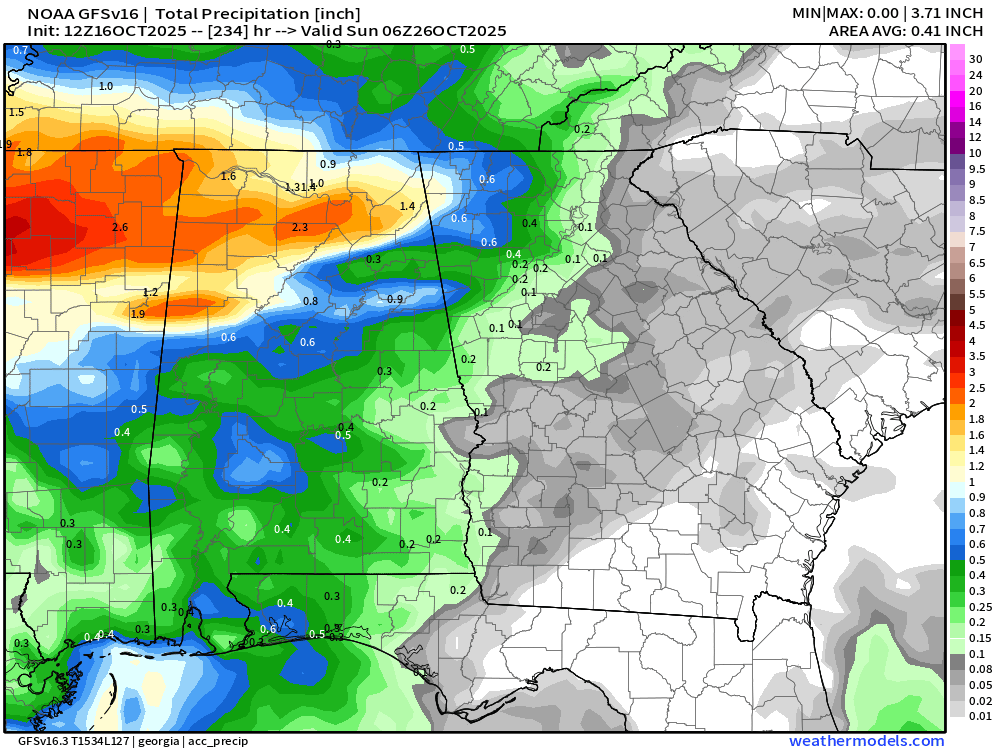

Outside of this front, no more rain is expected in the next 10 days. Worsening drought conditions are likely to continue through the end of the month. There are some signs of a more active storm pattern moving in by late month, but that is still 10+ days away so not worth hanging your hat on just yet.


