

While we have seen some rain across the state during the past week, it hasn’t been nearly enough to have much impact on the drought as it continues to spread across the state.
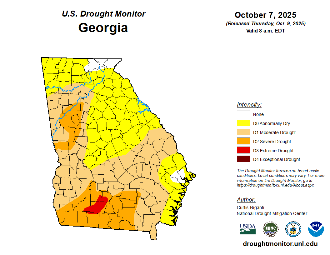
The latest analysis from the US Drought Monitor shows 97% of the state in at least a D0, or abnormally dry, drought. This is actually a 1% decrease since last week thanks to rains along the coast dropping the area inland of Savannah out of the condition. In comparison, just further inland far south Georgia now has the first D3, or extreme drought, zone in the state. Additional rainfall is expected along and near the coast into this weekend which will help ease concerns even more for the first tier or two of counties inland.
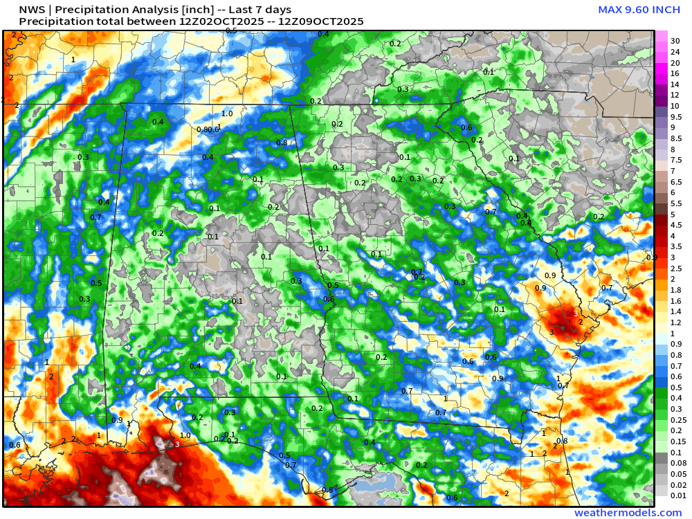
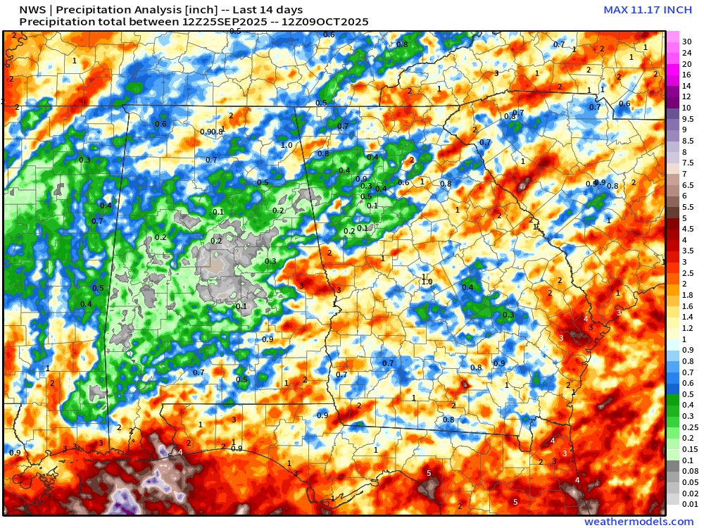
For the rest of us, the next 10-14 days look very dry with well above normal temperatures setting in. Locally over Northeast Georgia recent rains have kept any worsening of the drought in check, but we remain abnormally dry everywhere with the exception of the mountains. We generally have a 1-2″ deficit over the past 30 days across the region, with areas south of I-85 closer to 3-4″ in spots. Total rainfall over the past 7 and 14 days has been decent across Northeast Georgia, but the highest totals have been spotty and generally decrease the further south/west you live. For comparison, Cornelia has officially reported 4.68″ of rain since 9/9 (a surplus). Meanwhile, just up the street Toccoa has only picked up 1.93″ or about a 2″ deficit. This is a great example of just how spotty the rainfall has been.
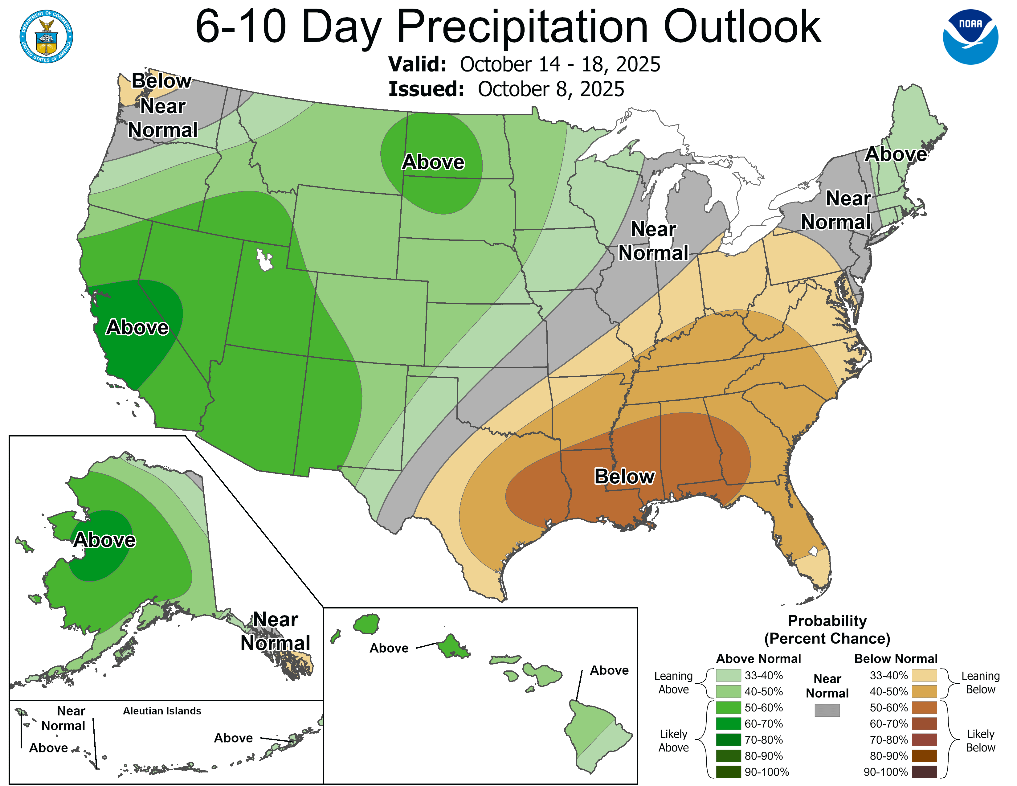
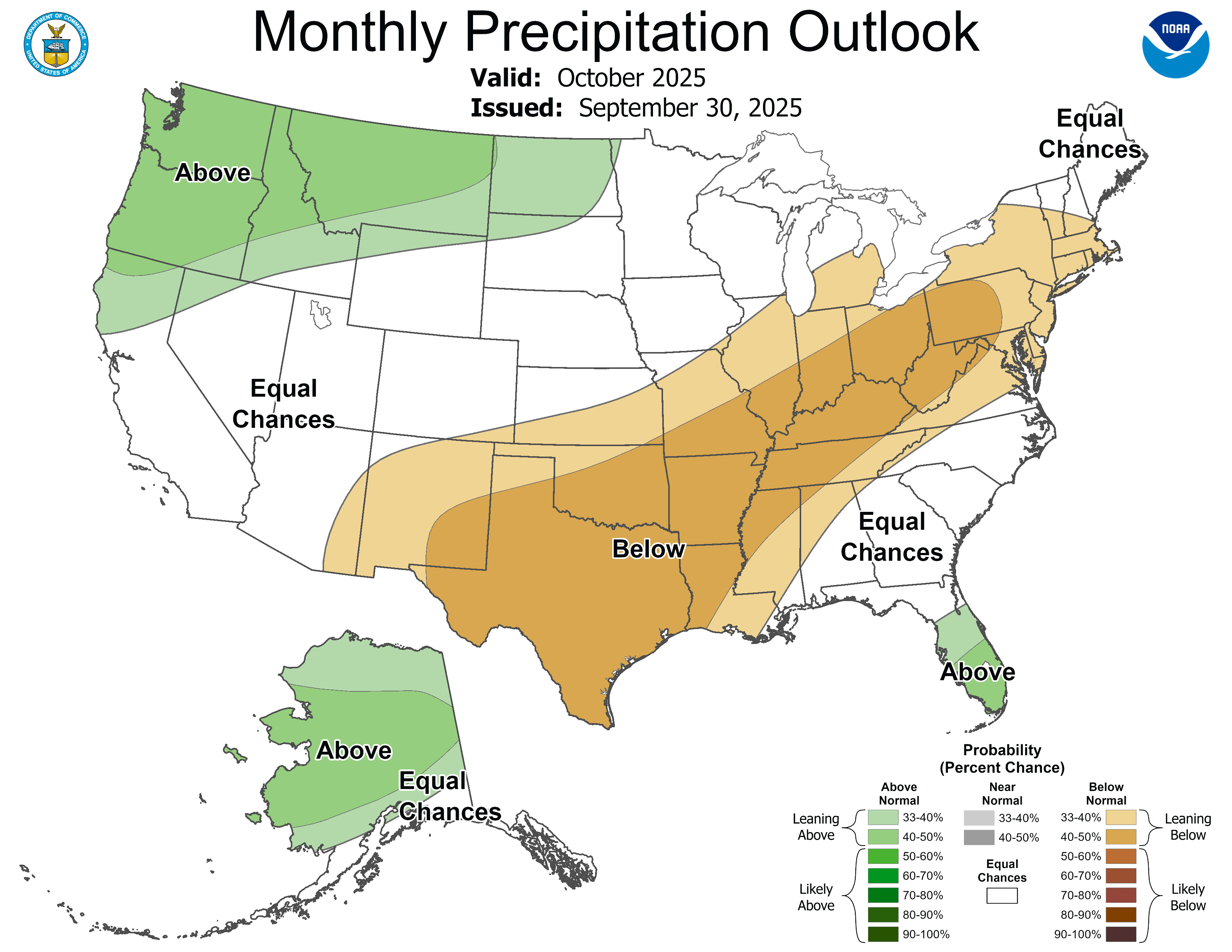
The forecast for the next 10-14 days is quite underwhelming. A nor’easter developing off the coast will help spread some showers into southeast Georgia this weekend, but beyond that there is no real chance for rain for the foreseeable future. October is statistically the driest month of the year so this isn’t a particularly big surprise, but that doesn’t make the risks any less. Both the 6-10 day and monthly precipitation outlooks can be seen below.
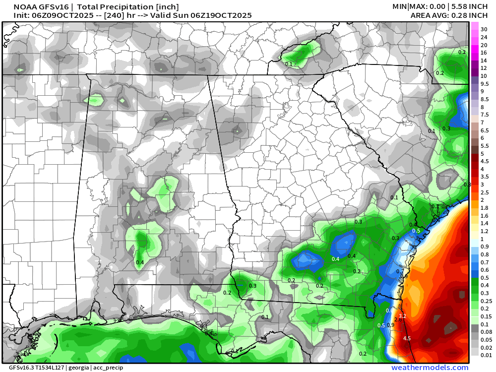
Weather models generally paint a picture of not only below average, but just zero rainfall. You can see both the Euro and the GFS forecast rainfall through the next 7 days below. Note: the rainfall on the Euro is the model picking up on some very small showers in west Georgia Thursday, which are thus far not verifying significantly.

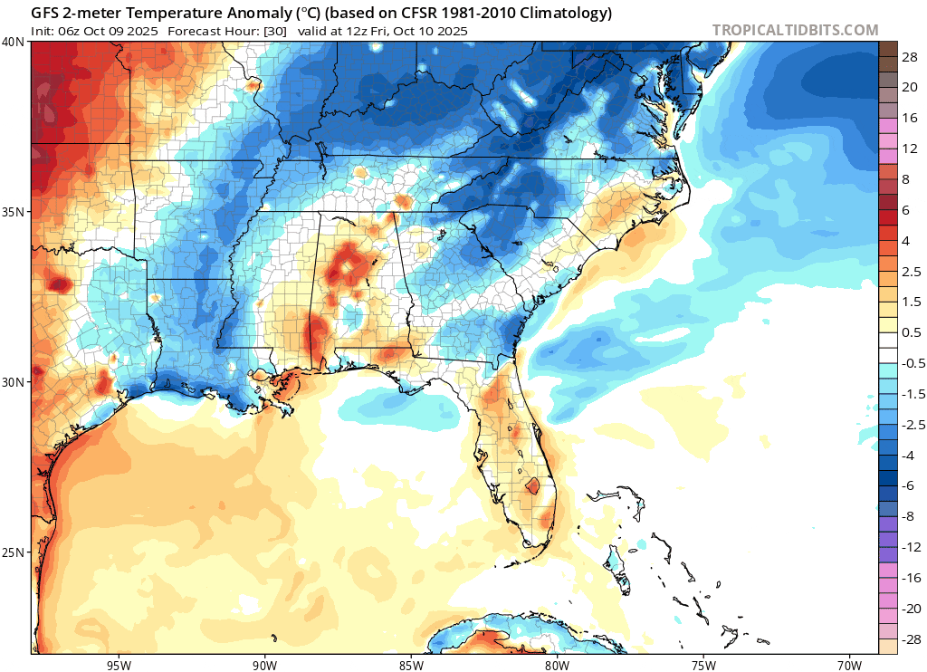
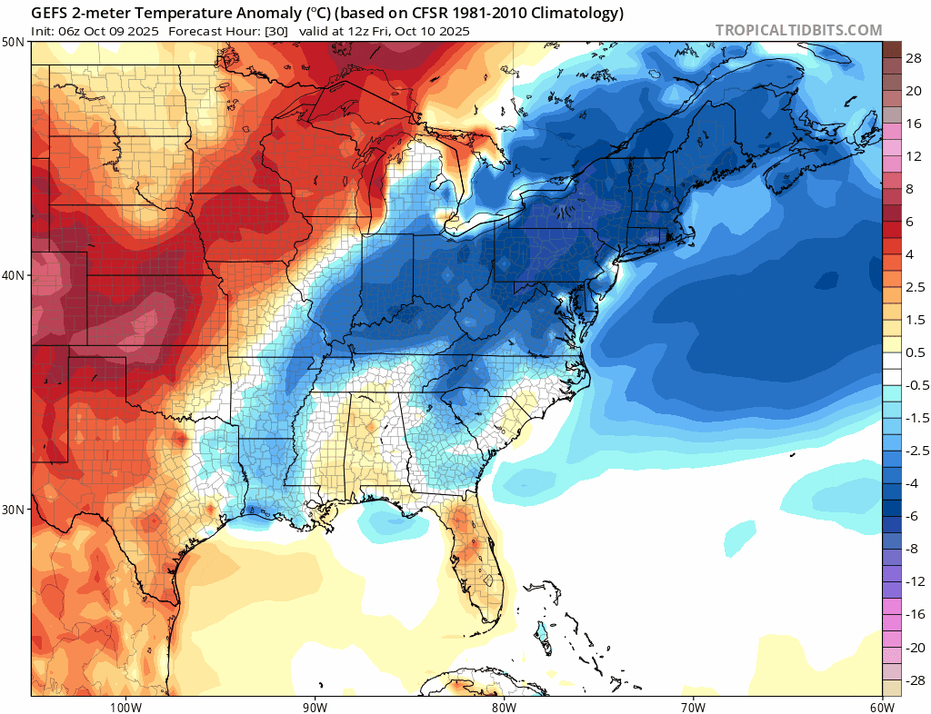
This dry spell will come hand in hand with some significantly above average temperatures across the entire southeast. It is too early to say for certain, but we could be challenging daily records across the entire region by next week. The animation below shows the growth of the above average temperatures and shows some areas reaching 15-20º above average.
Like with every long-range forecast, though, we need to take into account any one individual model run can significantly overdo things. The bad news is that the generally more accurate ensembles paint a similar picture. While they don’t show the extreme peaks of the operational GFS above, they do show continued warm weather.
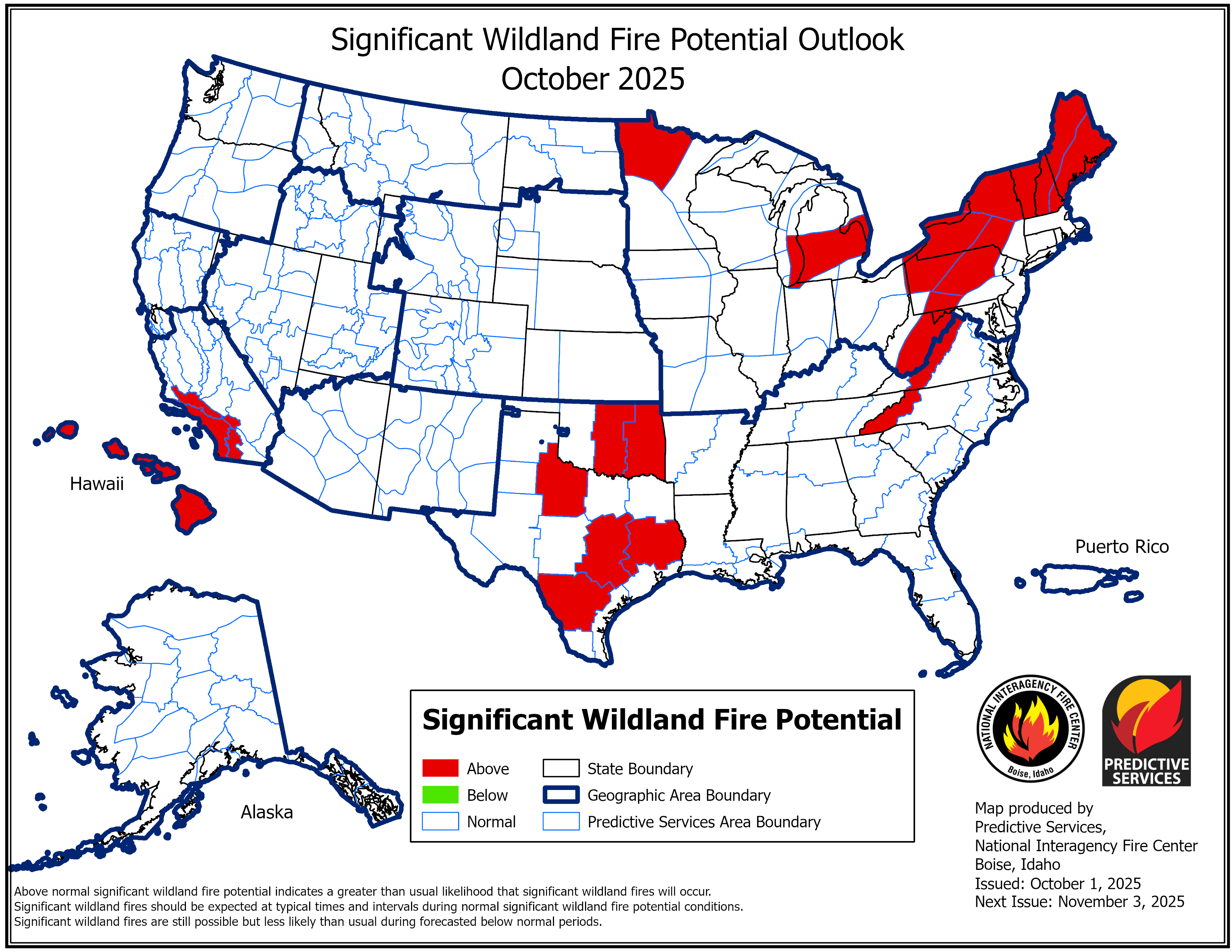
The warm/dry weather combined with the lack of rainfall will allow the drought to rapidly expand for at least the next 7-10 days and likely beyond. We are also heading into our local wildfire season, which will be made more complicated by deadfall from Hurricane Helene last year along with plentiful leaf litter from early tree leaf drop due to the warm/dry weather. Currently our neighbors in western North Carolina are seeing an increased risk for wildfires, and this is likely to spread over the next month. We strongly recommend limiting and being very careful with any outdoor burning in the coming weeks. It only takes one errant ember to cause major problems.
Leaf color season is likely to be impacted negatively and will likely also be pushed back.
Stick with Now Habersham for the latest!


