

We’ve seen several brushfires cause issues across North Georgia in the past day, with several others also reported across the state. More are likely in the coming couple of weeks because, despite some rain on Friday night, we are expected to remain largely dry for the foreseeable future.
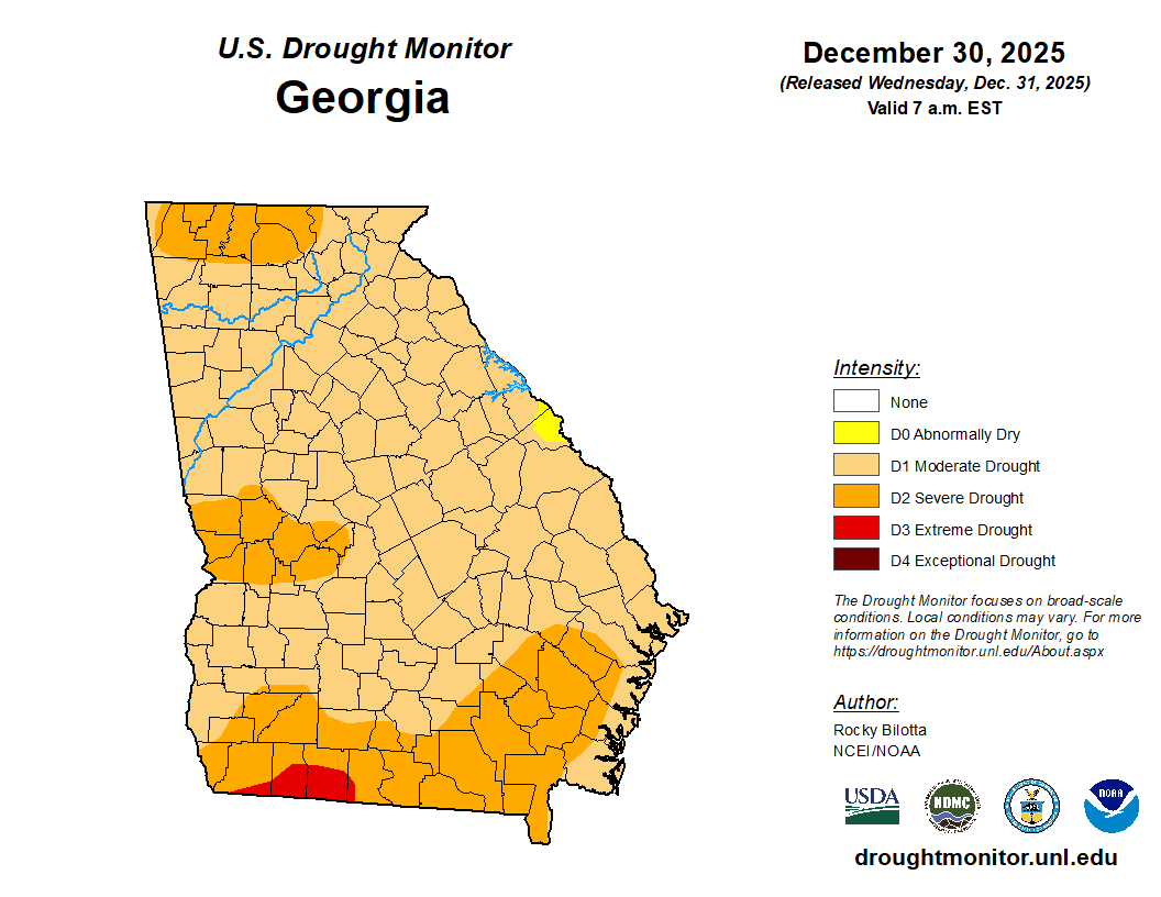
The latest from the US Drought Monitor now shows 99.63% of the state in a D1 (moderate) drought or higher. The only sliver still in only D0, abnormally dry, lies in Richmond and Columbia Counties along the Savannah River in east central Georgia. A large area of D2, severe, drought is rapidly expanding across northwest and north-central Georgia as well now reaching as far east as Union County.
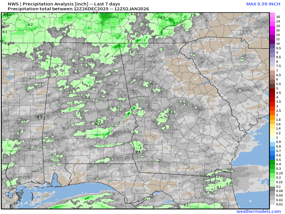
This shouldn’t come as a surprise to anyone as it has been very, very dry recently. A quick look at the past 7 and 30 day rainfall totals across the southeast paint a very sad picture. Much of the north/northeast section of the state has seen less than 1″ of rain in the past month. In fact, north of Macon only Rabun County has seen any real meaningful rainfall in the past month. Generally, only 1-1.5″ has fallen.
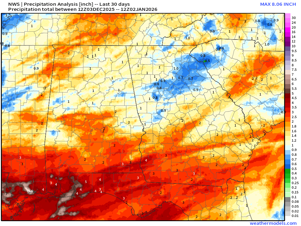
This is bad timing since December into January is the wettest time of the year for the majority of the state. Monthly averages for both December and January range from 4″ over central Georgia to as much as 6″ over the mountains. This has driven our rainfall deficits significantly higher with 30 day deficits around 3-6″ across the northern half of the state.
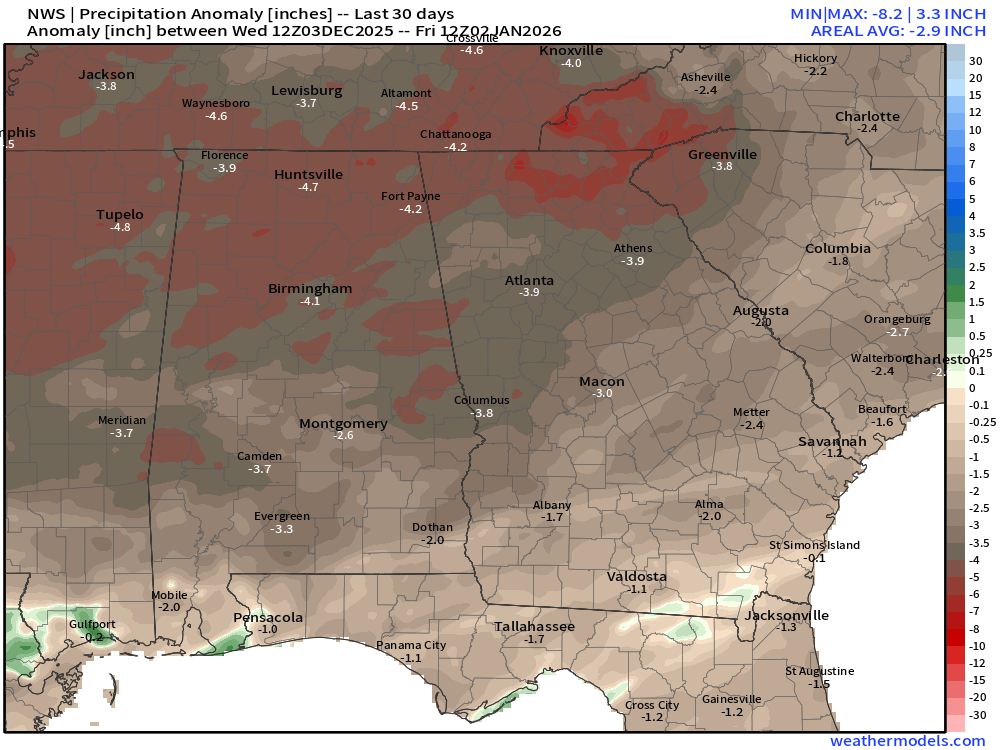
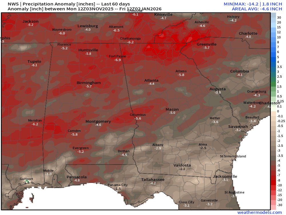
60-day deficits look even worse, with sections of Northeast Georgia showing 8-10″ below average since the beginning of November. Central Georgia has fared only slightly better with a handful of Gulf systems and deficits in the 4-7″ range. Far south Georgia, where an extreme drought was underway just a couple months ago, have seen significant improvement.
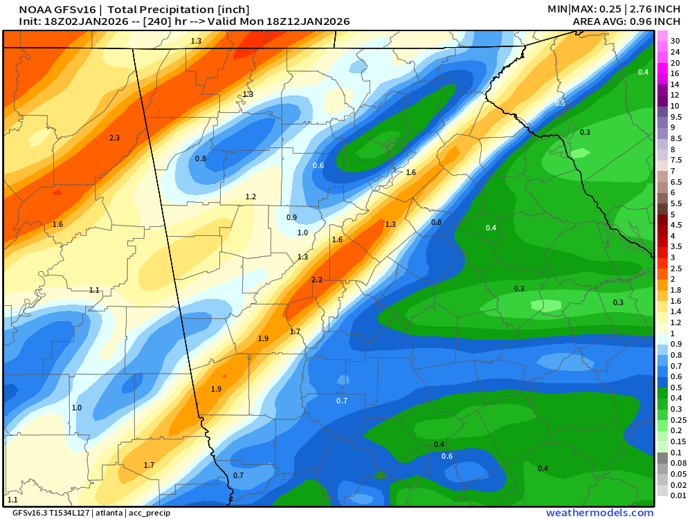
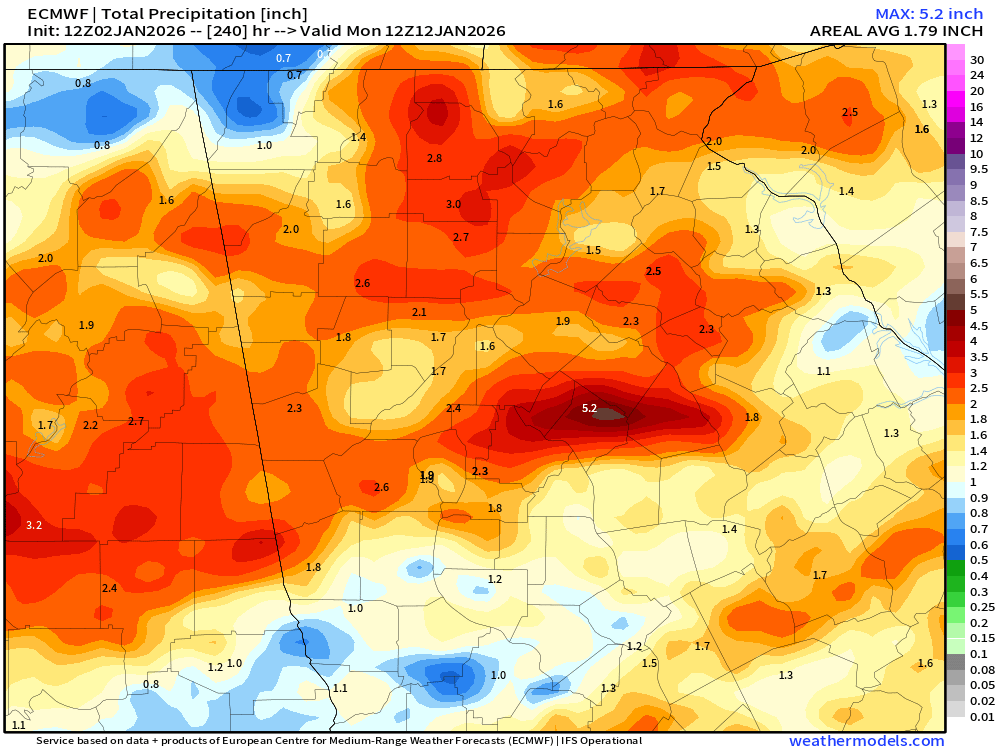
Unfortunately, we won’t be seeing any significant rainfall anytime soon. The latest modeling shows around 1″ for the system on Friday and Saturday but very little beyond that. There are some signs, mainly from the European model, for some decent rainfall late next week. The latest 10 day rainfall forecasts from both the Euro and GFS models are below.
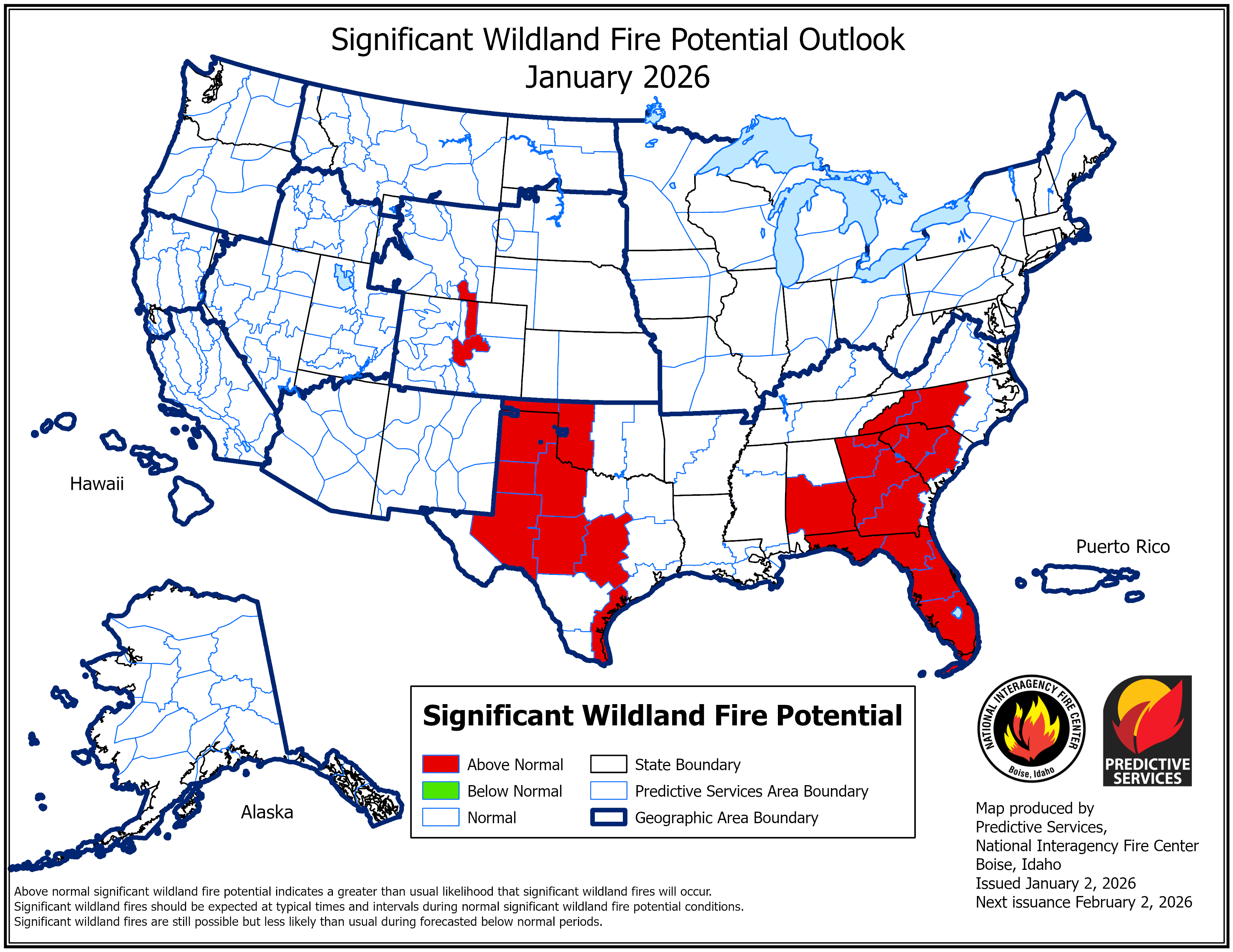
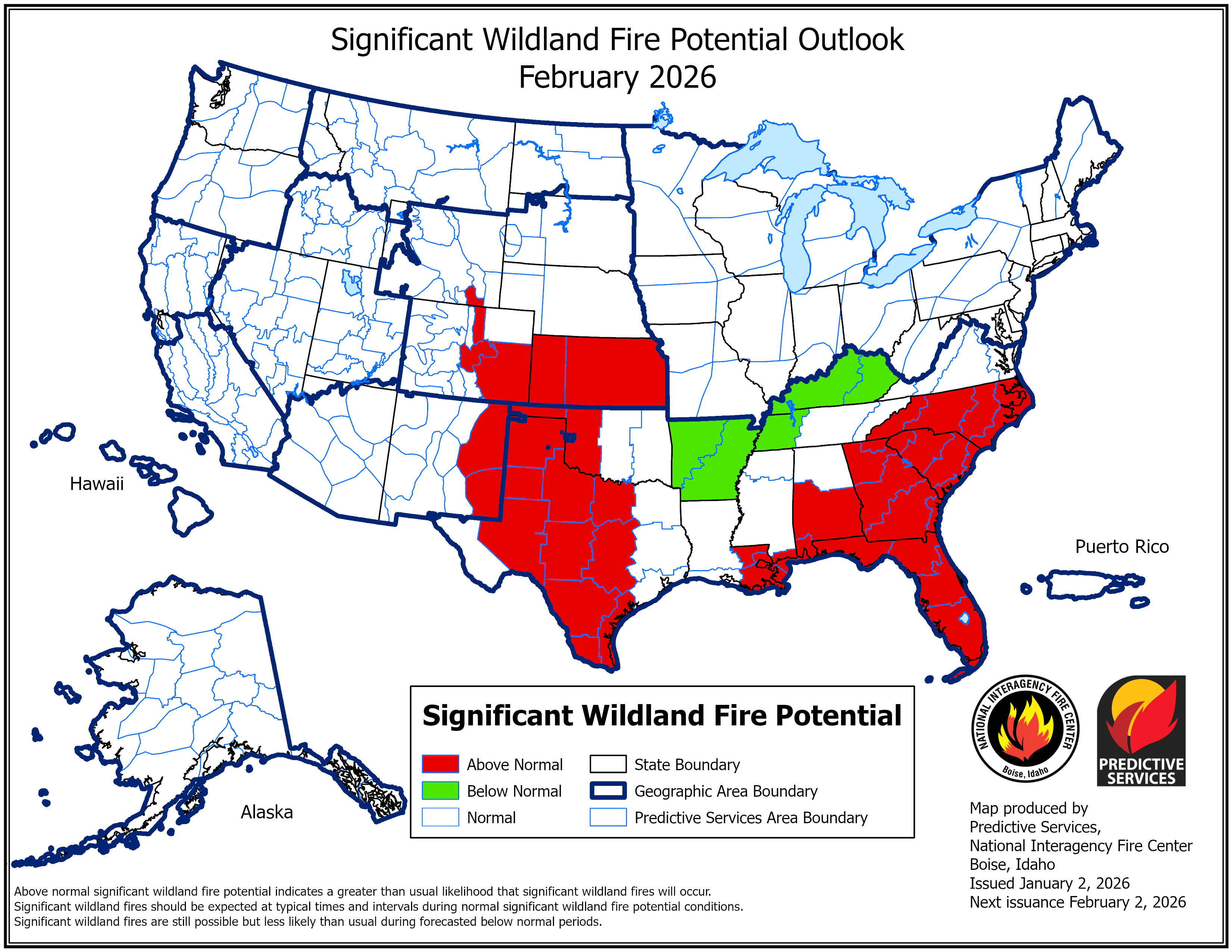
Because of this, the NICC keeps all of Georgia under an above normal risk for significant fires over the next couple of months. With the current long range upper level patterns, a switch to a predominantly wet pattern seems unlikely though not impossible.
We here at Now Georgia strongly encourage you to keep a very close eye on our Fire Danger forecasts that we put out each day. Do not do any burning if the risk is high and up, and use extreme caution on moderate days.


