

While it seems like it has been wet recently, and it has to some extent, drought has continued to expand across the state.
After we saw a nice reprieve in drought conditions over the past couple of months for a big portion of the northern half of the state, the latest US Drought Monitor analysis shows at least abnormally dry conditions spreading to cover all of North and Central Georgia.
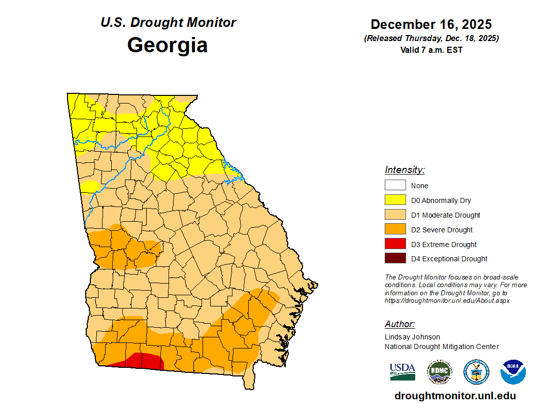
82% of the state remains in at least D1, moderate drought, and this includes parts of extreme North Georgia, as well as all areas along and south of I-20. Further south over west-central Georgia an area between Columbus and La Grange remains in a D2, or severe, drought. The biggest improvement we’ve seen has come over the extreme southern part of the state. Just 2 weeks ago a large area of D4, or exceptional, drought was in place. Multiple rounds of rainfall have completely eradicated the exceptional drought area and only a small area of extreme drought remains.
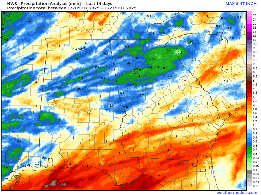
Precipitation analysis from the National Weather Service shows this South Georgia rainfall very well where a widespread 2-3″ has fallen in the last 14 days. Areas along the I-20 and I-85 corridors have seen the least rain in the past two weeks with only 1/2″ or less. The vast majority of the northern portion of the state has seen less than 1″, with the exception being Rabun County where 1-1.5″ has fallen.
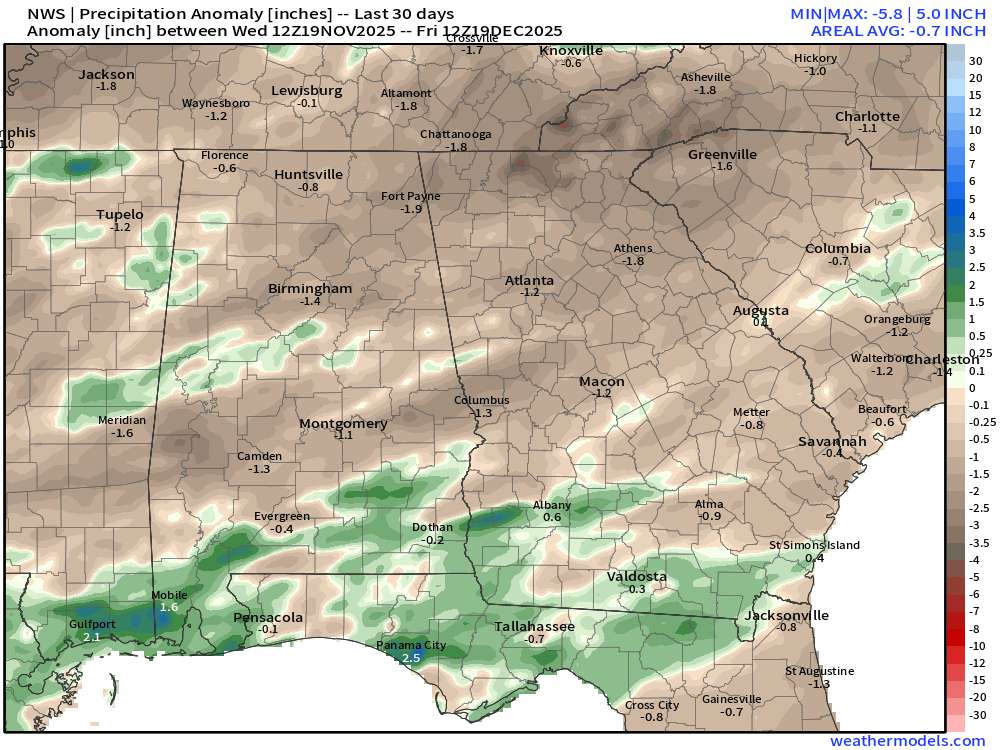
30 day deficits have actually turned positive over south Georgia, but for the northern 2/3 of the state we are short anywhere from 1-2″ of rainfall in the past 30 days.
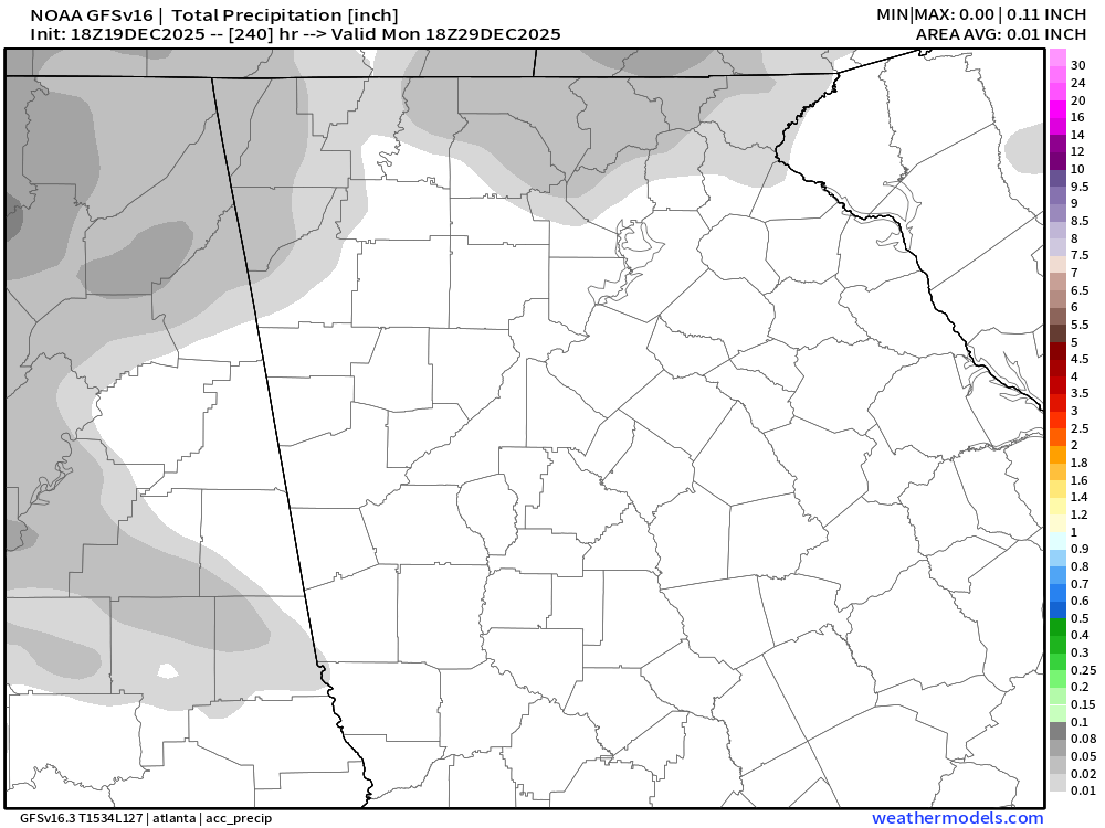
This isn’t anything particularly alarming, however we are entering a period of very dry weather likely to last through most of the rest of the year. The latest modeling shows little, if any, rain over the next 10 days and there is no guarantee of when our next significant rainfall will come. You can see the current forecast from the GFS Model below that shows only very light showers in a few areas between now and December 30th.
This will likely lead to worsening drought conditions over the next 2 weeks or so, with potential for this to continue over into January. The dry, coupled with low humidity and well above average temperatures, will likely result in periods of very high fire danger. Keep a very close eye on the latest fire danger forecasts and avoid any outdoor burning during periods of high or very high risk.


