

Editor’s note: In July 2025, Now Habersham weathercaster Tyler Penland headed west to hike and camp in Yellowstone National Park. His latest “Go West, young man” series features the stunning images he captured and the stories he brought back.
After leaving the Mammoth Hot Springs, we could already see our next target. Bunsen Peak sticks out like a sore thumb as you drive north into the broad valleys of the northern end of Yellowstone National Park. This mountain is some of what remains of the parks rich volcanic past. The igneous rock peak with very few trees near the summit is directly south of Mammoth Springs.
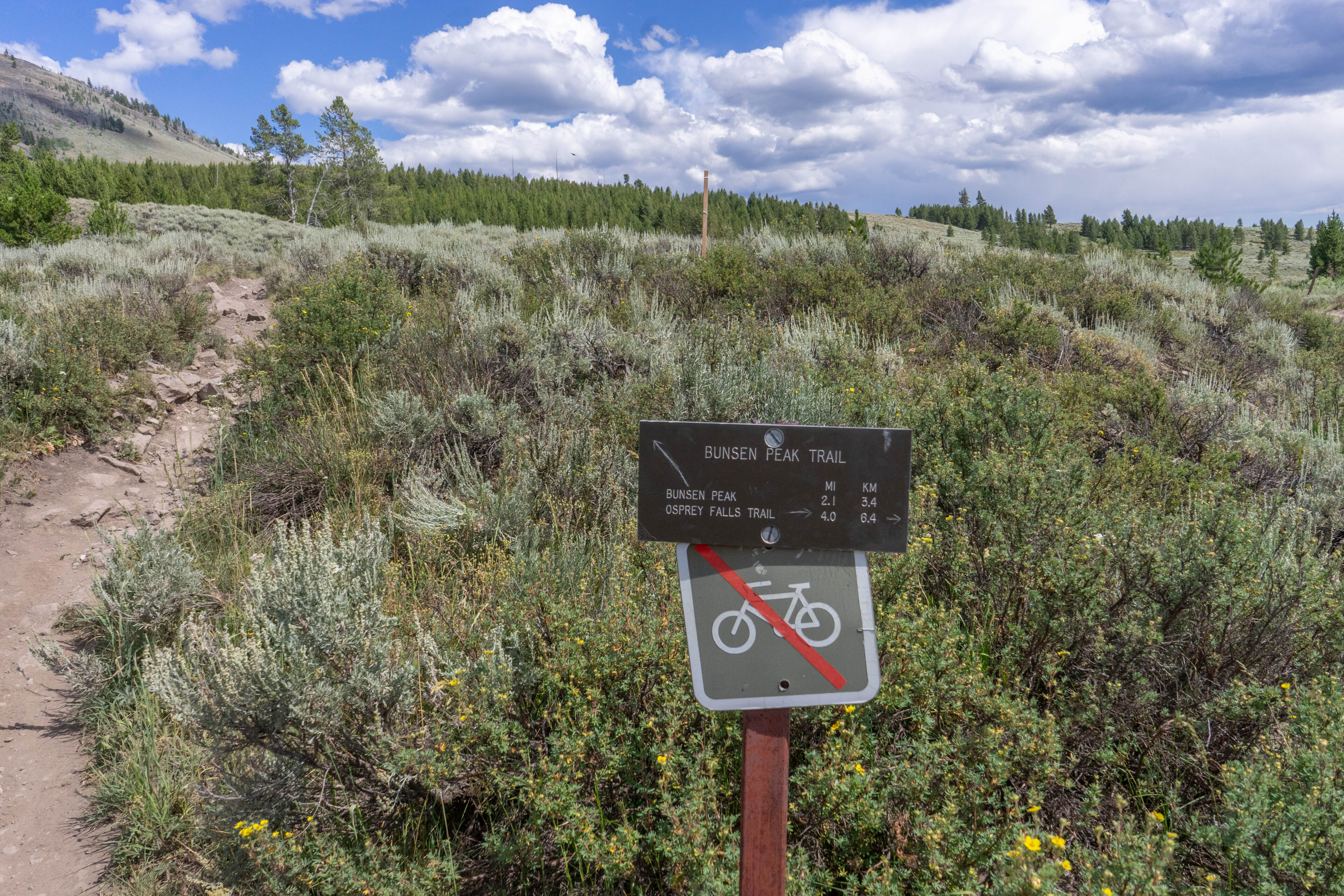
Photo: Tyler Penland
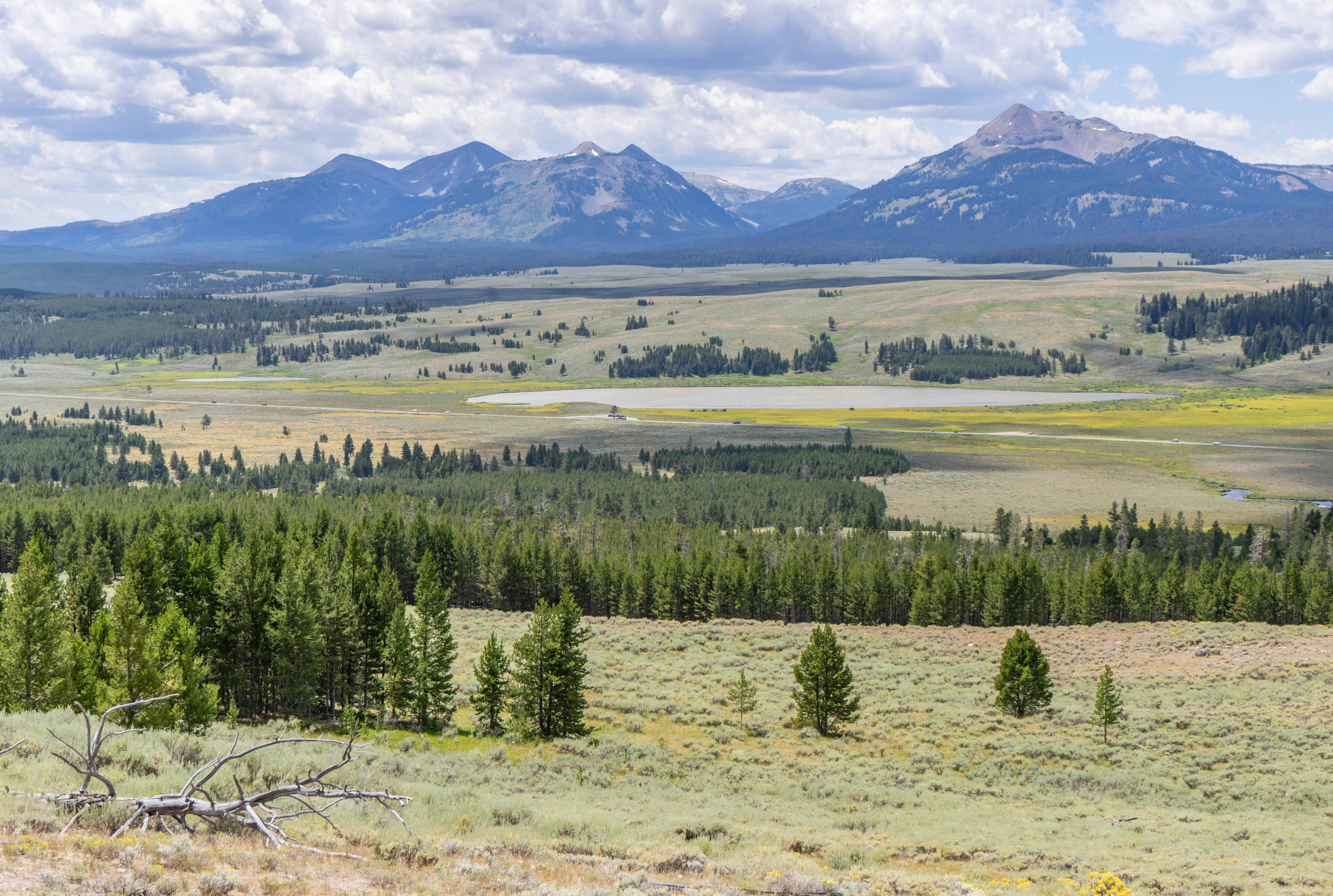
This 4.2 mile out-and-back trail takes you up well over 1,000 vertical peak to an elevation of 8,564 feet, our first “high elevation” hike of the trip. The trail quickly goes uphill and while the views from the base are great, they get truly grand as you work up the hill. You quickly come to a high elevation meadow that on this beautiful mid-July day was absolutely covered in beautiful wildflowers. A lone tree towards the middle caught my eye growing at a steep angle to keep growing straight up. The mountains with lingering snow in the background were truly a sight to see.

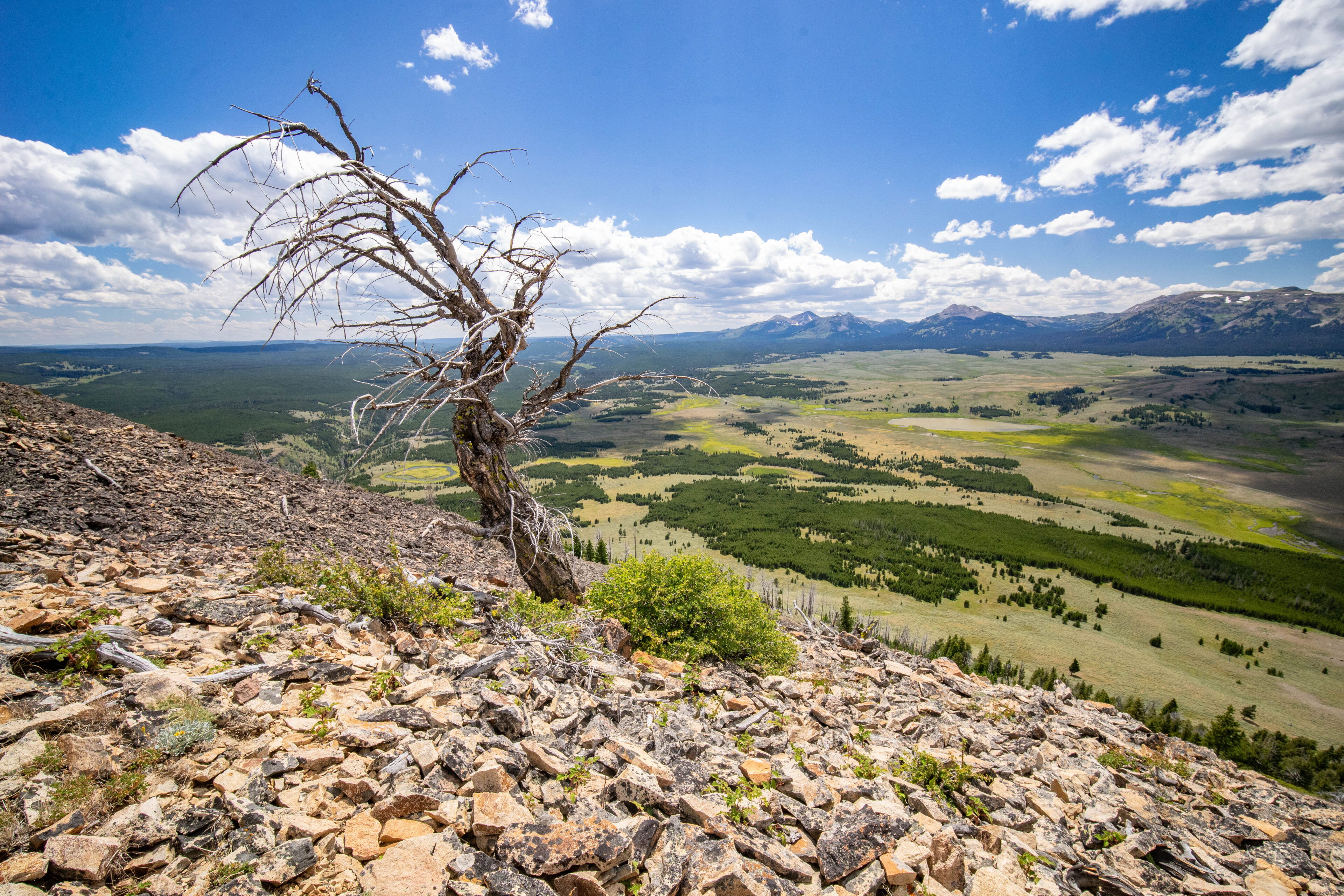
It doesn’t take long to find some of the real volcanic remains as you continue to huff and puff your way up the hill. You’ll find some gooseberries on the sides of the trail just before you emerge at this great vantage point. Again, a lone tree, this time dead, dominates a photographer’s eye with the sharp red spires. You can see the Mammoth Cave Area in the distance from here quite well.

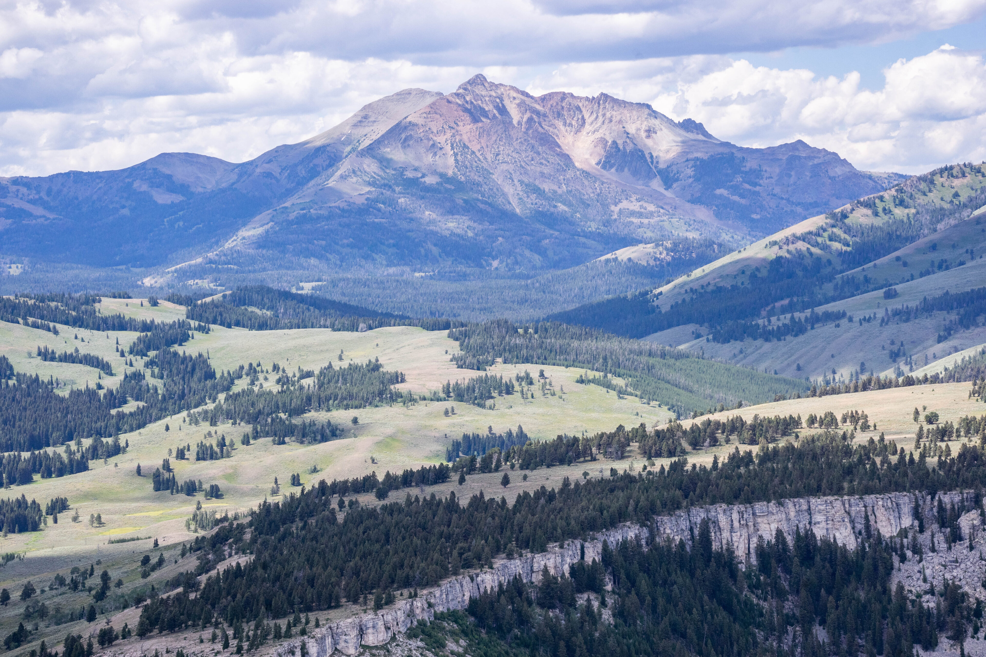
The trail gets very steep as you near the top which required us to take several breaks. This was my first time hiking at over 8,000ft elevation since October of 2023 in the Great Sand Dunes, so I was really feeling the elevation less than 24 hours after my arrival from the “lowlands”. The trail becomes nothing but loose rock towards the top, and eventually we did arrive at the peak marked with a shelter and communications tower. You can find a hiker sign-in book as well as an elevation sign at the shelter. This is also a great place to get a break from the sun that is very tough in the dry air. On this particular day it was quite windy, although I imagine it is quite windy most of the time. The tall 10,000ft or higher peaks to the west really stand out.
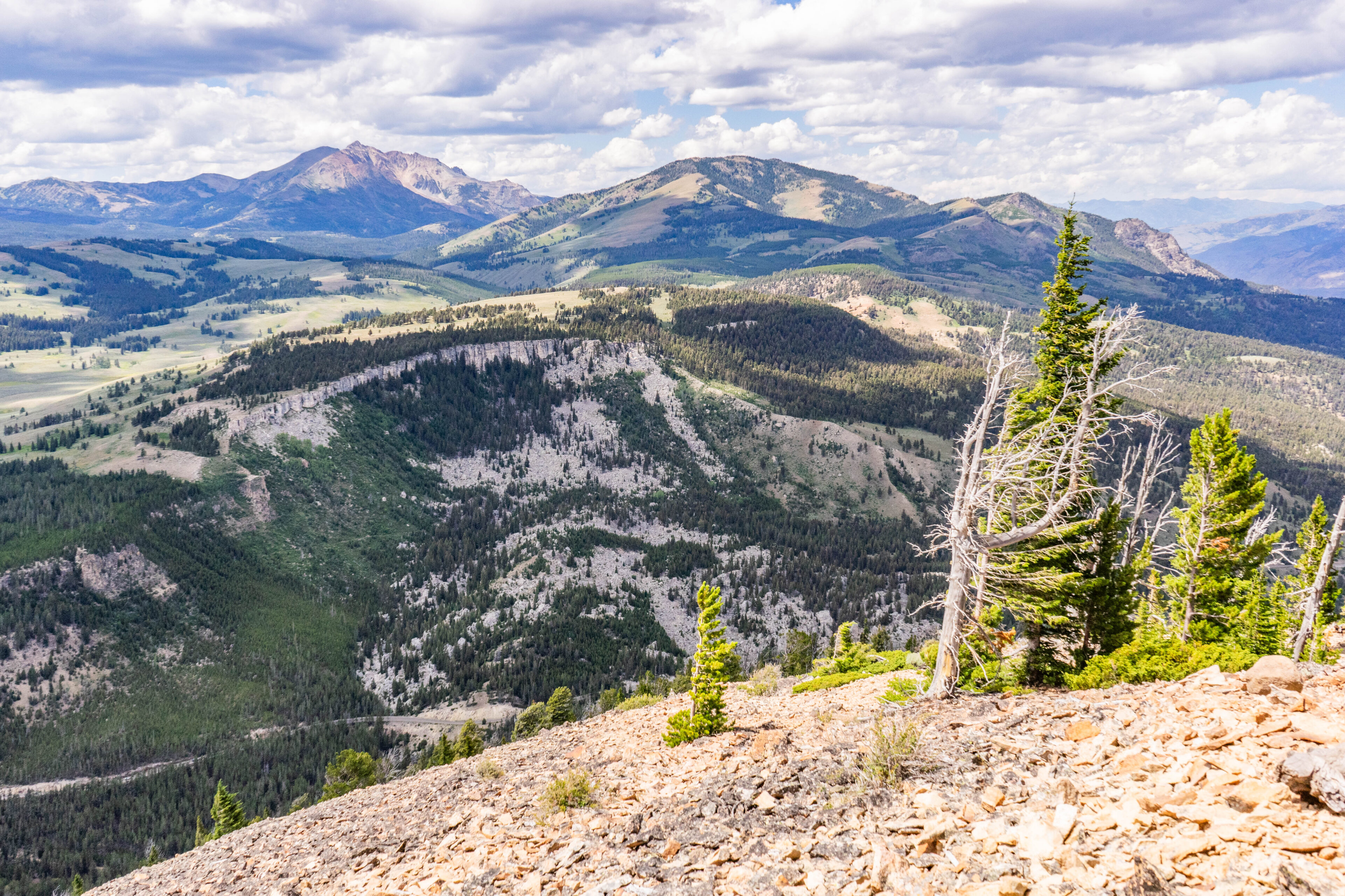
Once again, I managed to find a photogenic, dead tree standing alone at the top of this rocky mountain. The views looking to the east, south and west are by far the best with the northern direction being more blocked by trees from the main rock face.
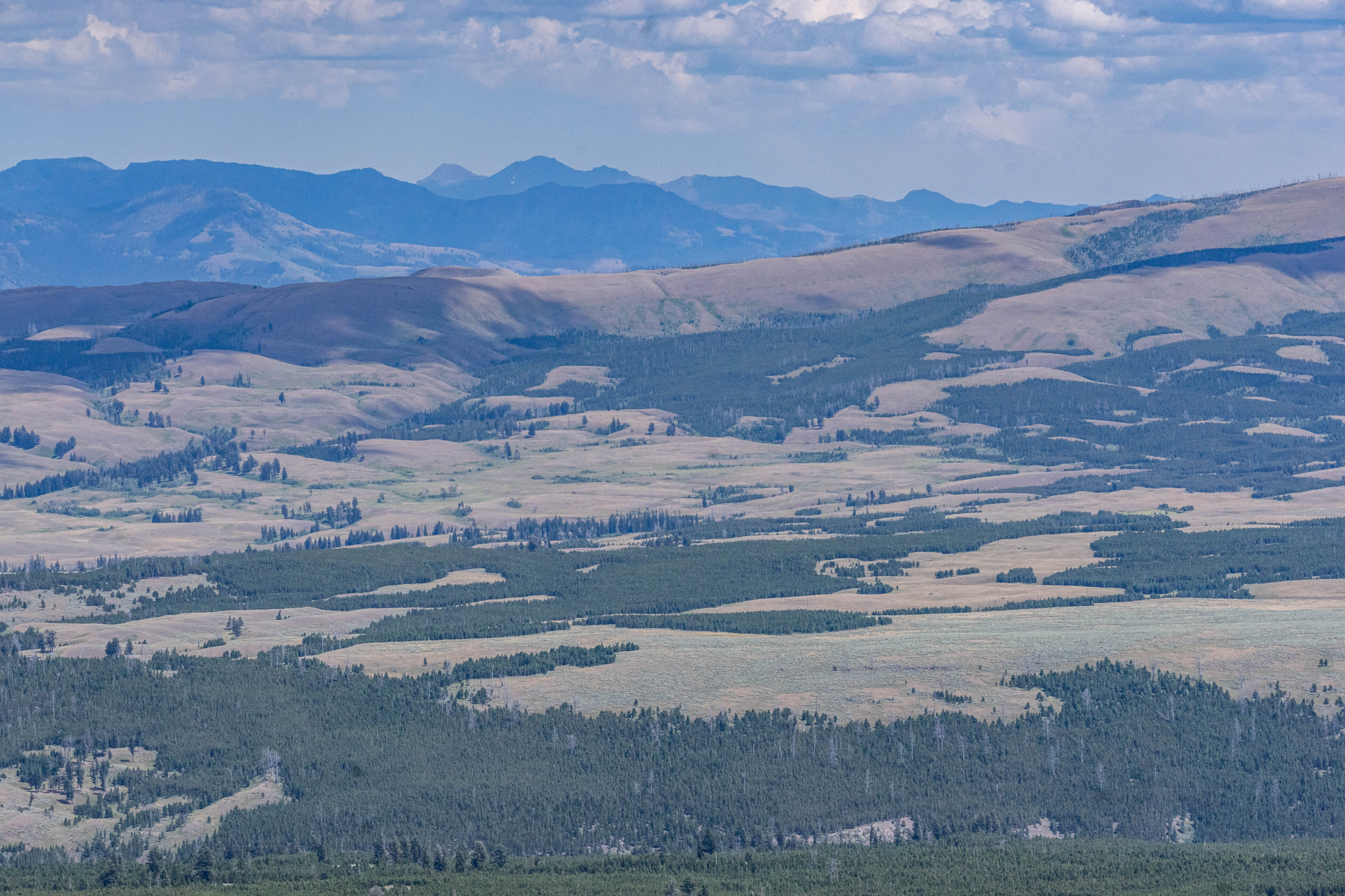
If you turn around and walk through the trees, there is one quite good view looking off to the north/northeast. It was somewhat hazy on this particular day, but you could still see all the way to the Absarorka-Beartooth Wilderness and the Beartooth Plateau, a place we would visit in just a few days time.
After spending a bit at the top and having a snack, it was time to make the much easier hike down the steep slopes. We stopped once again to admire the view looking over the valley below on the way down, looking deep into the heart of Yellowstone country.
We arrived back at the truck and after a quick lunch it was time to go see more stuff. We were on a time constraint, after all, and the exploding ground doesn’t like to wait…..
Other articles in this series:


